SOUTHERN AFRICAN MAPS
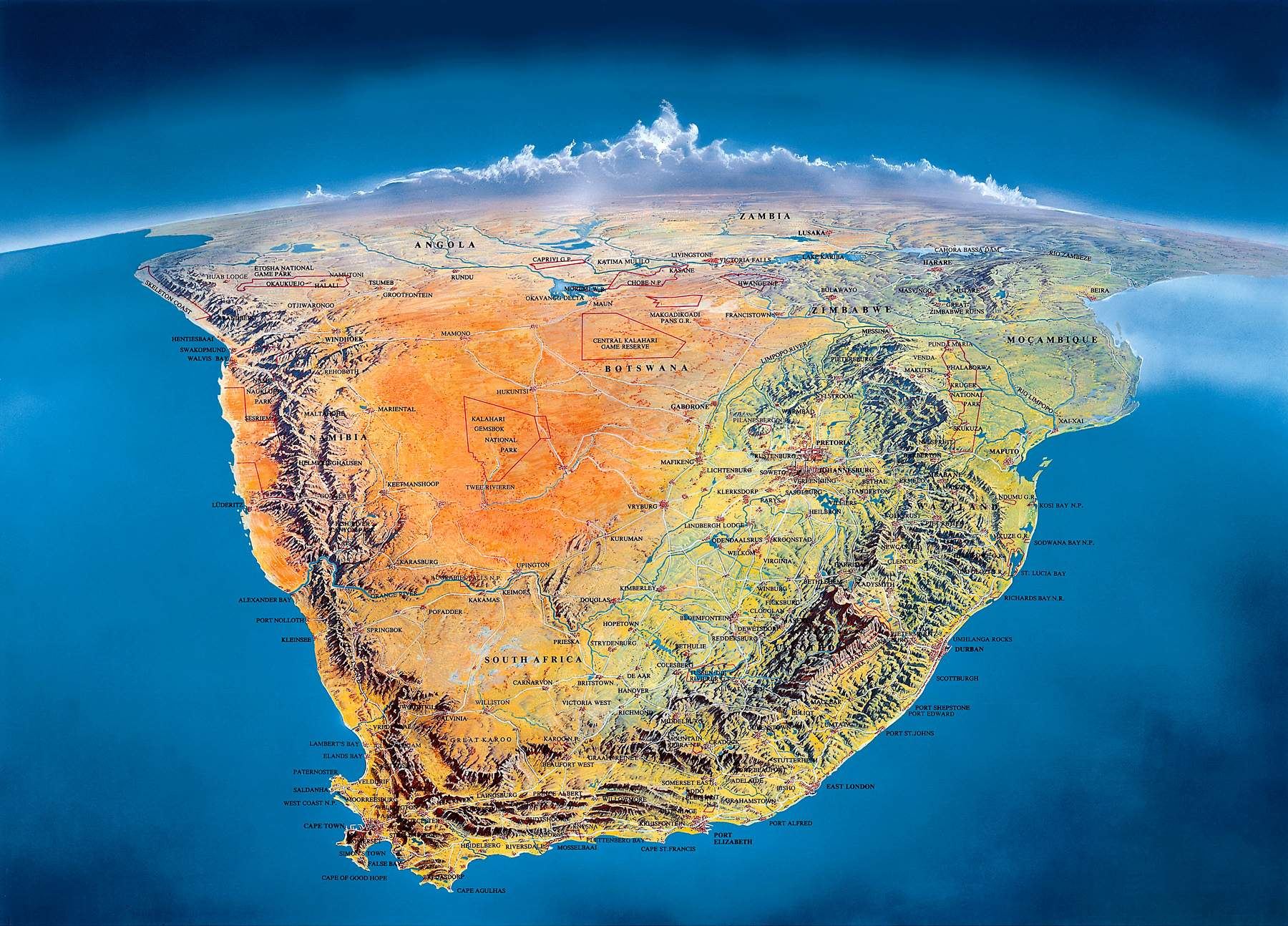
@ Southern Africa panorama map
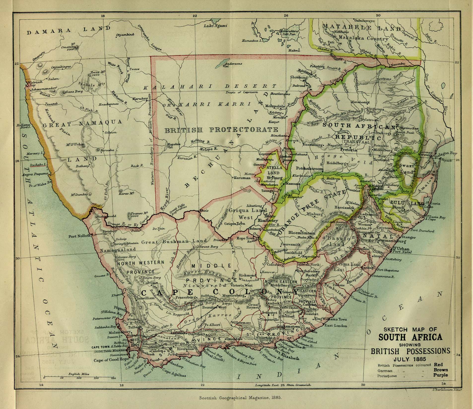
@ Southern Africa 1885
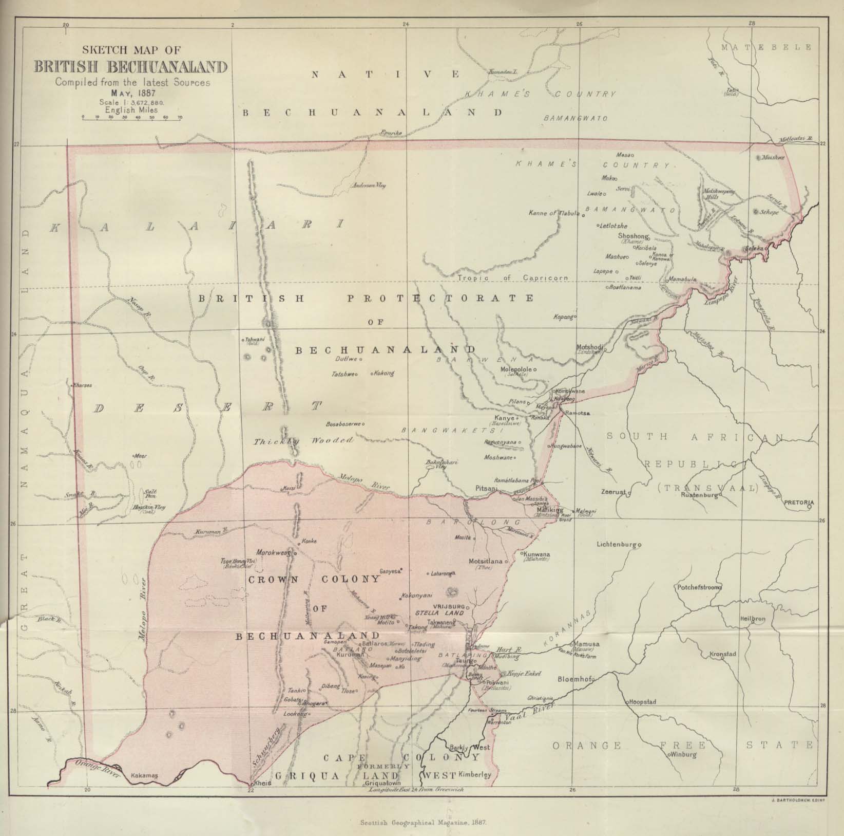
@ British Bechuanaland
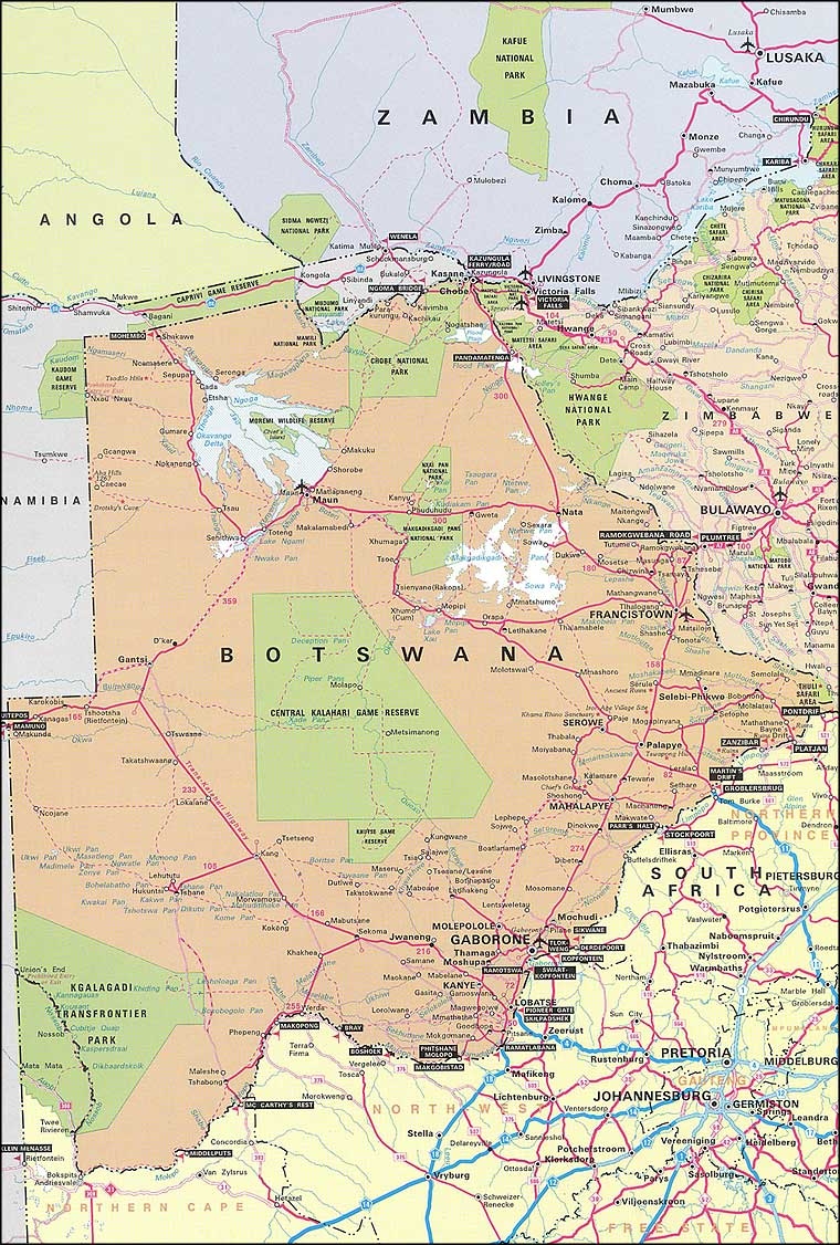
@ Botswana
@ General map
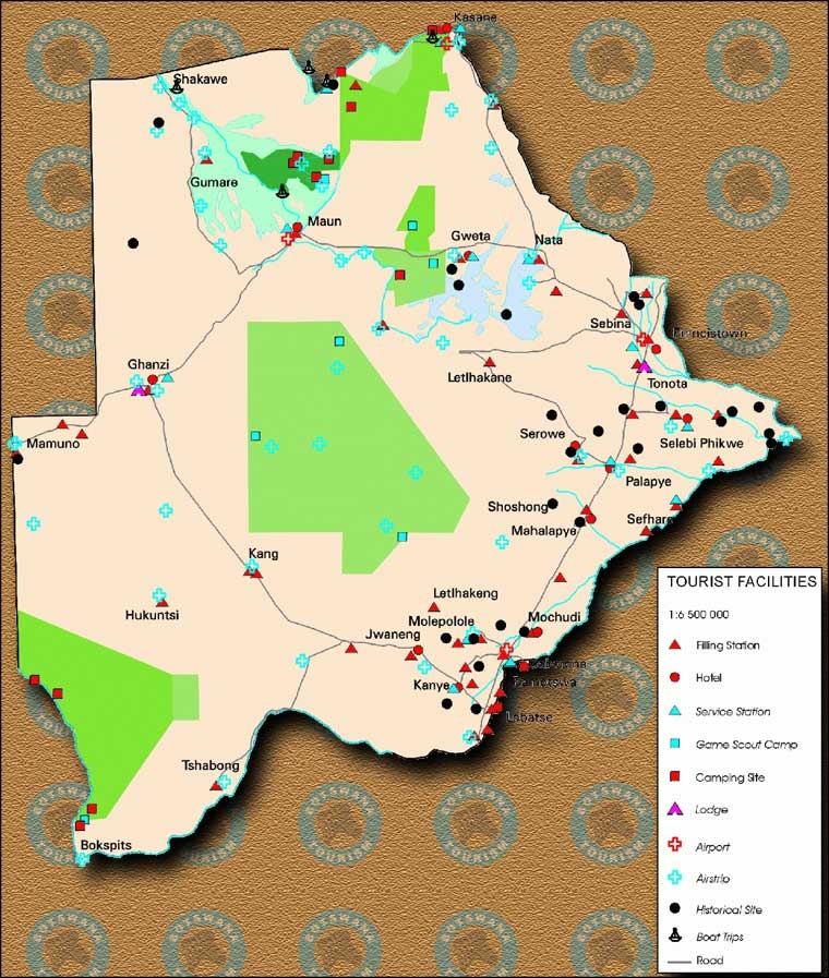
@ Tourist map
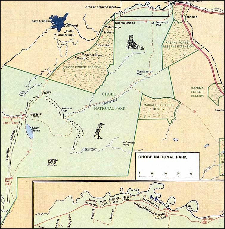
@ Chobe map
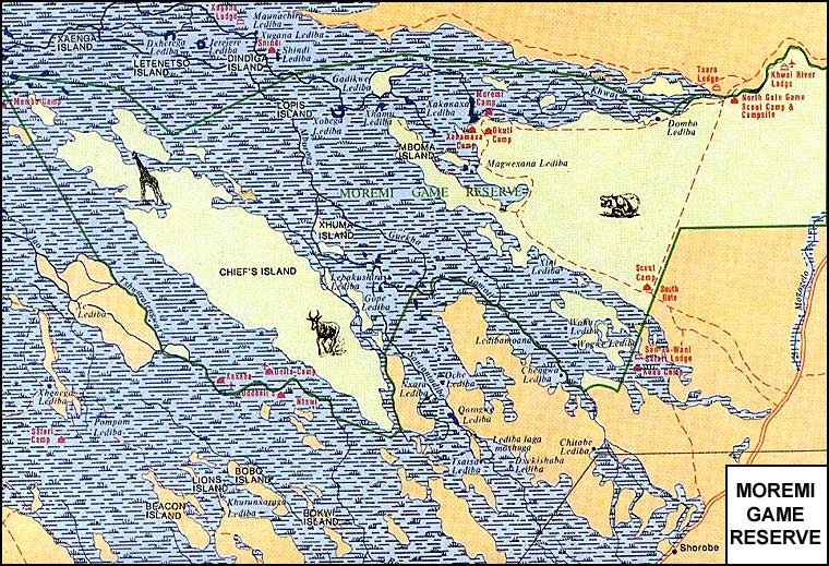
@ Moremi map
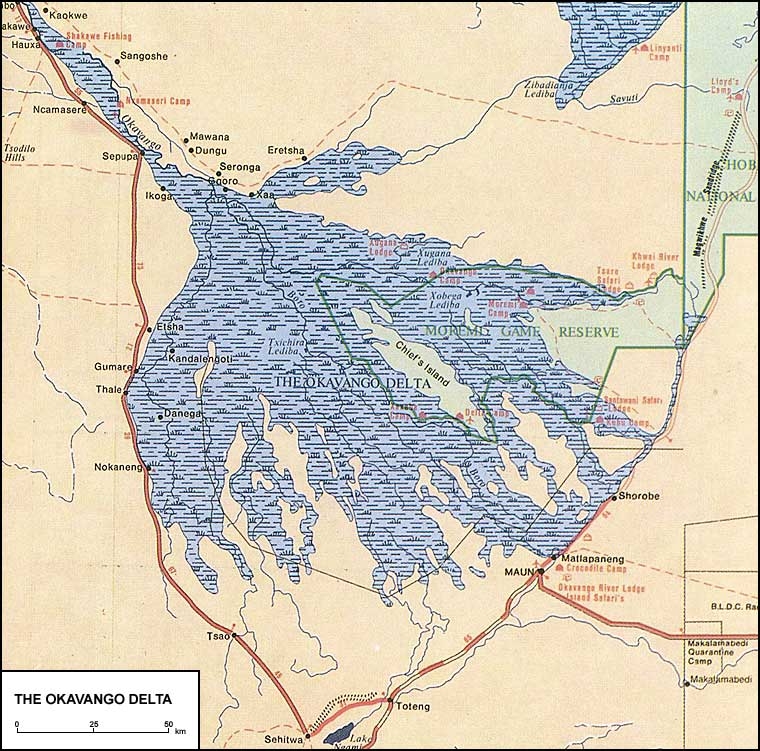
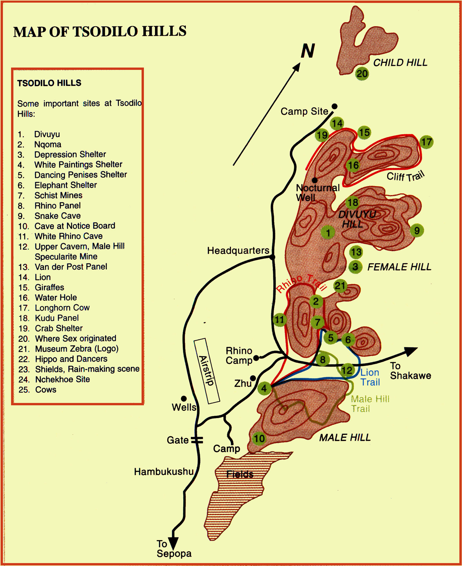
@ Okavango map
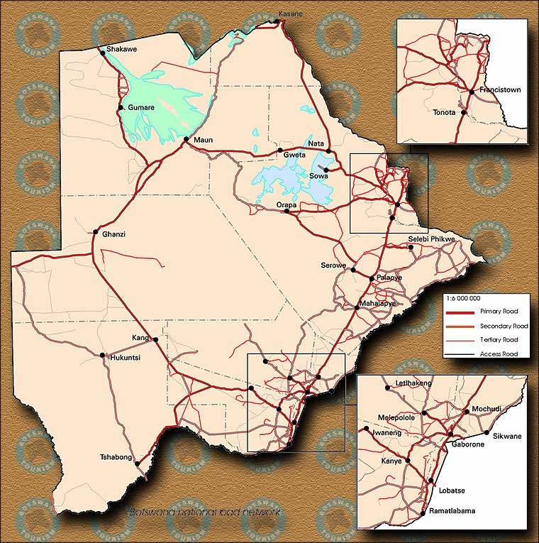
@ Road network map
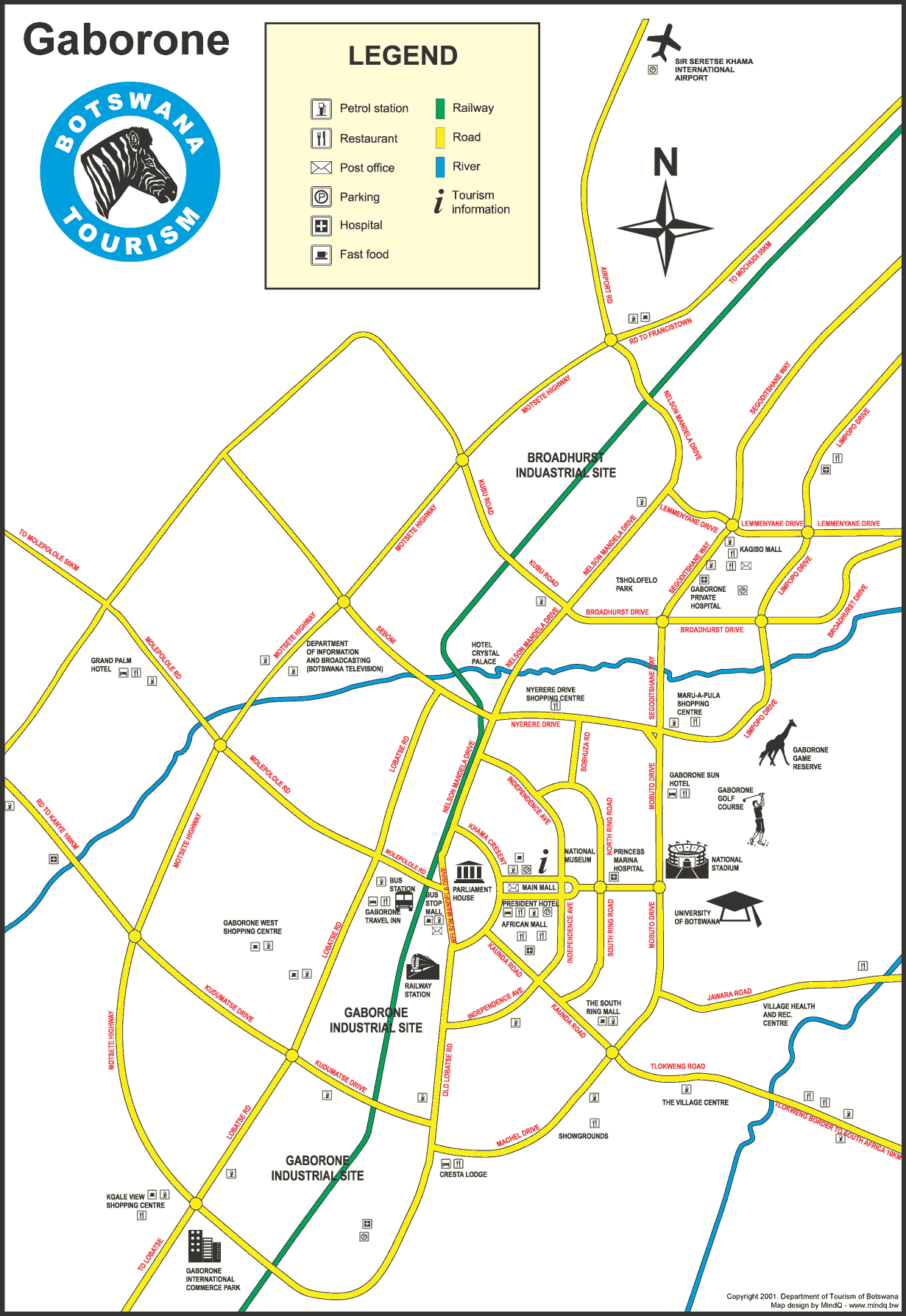
@ Gaborone tourist
map
@
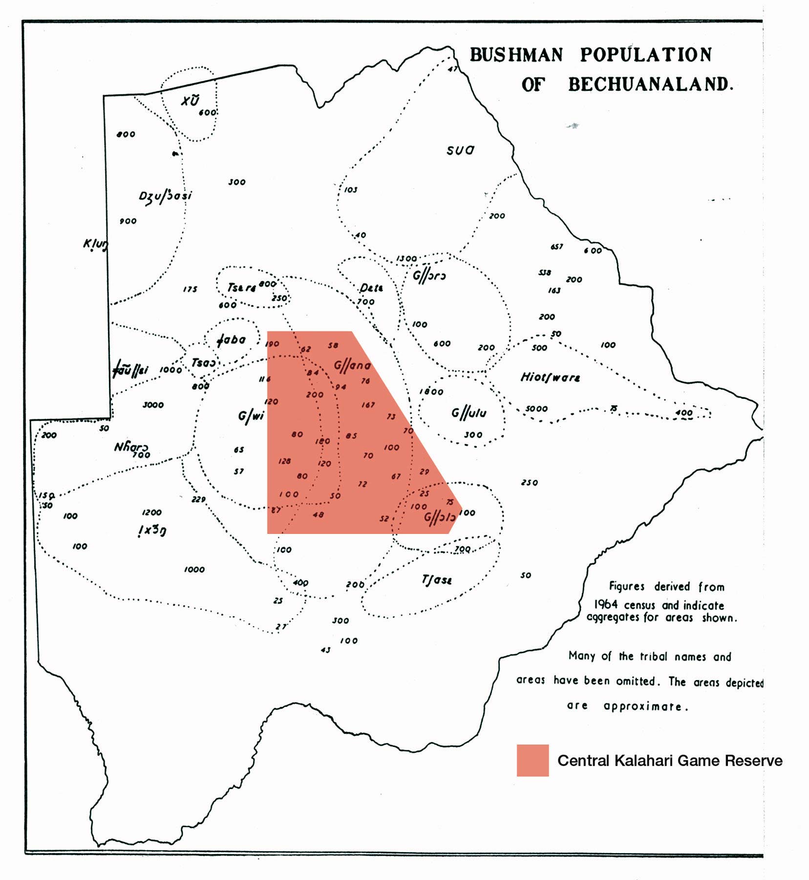
Bushman population 1964
@
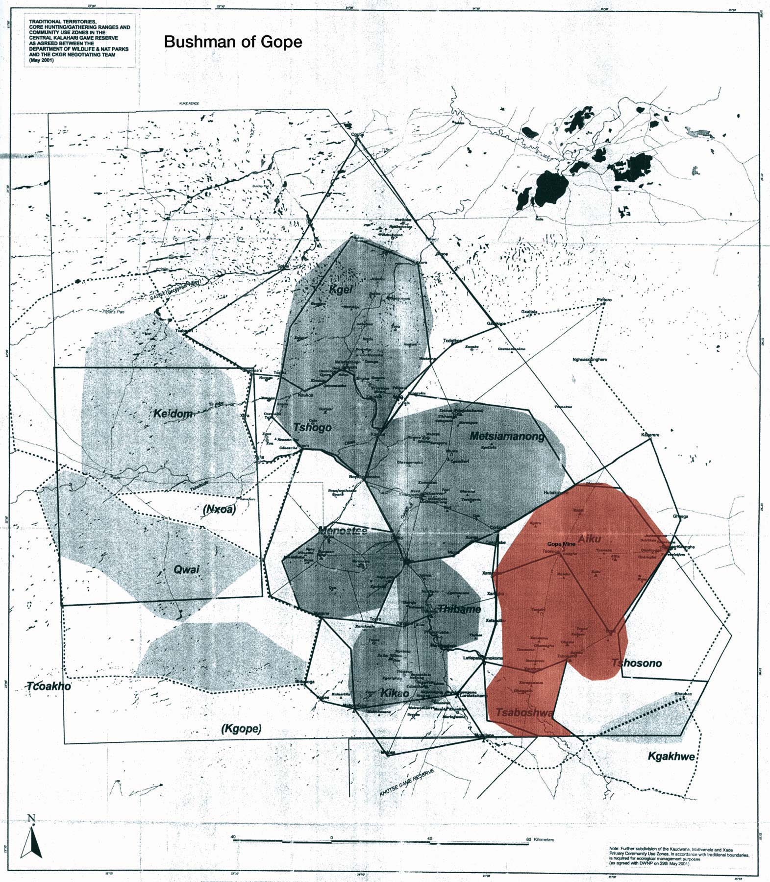
Bushman of Gope in
CKGR
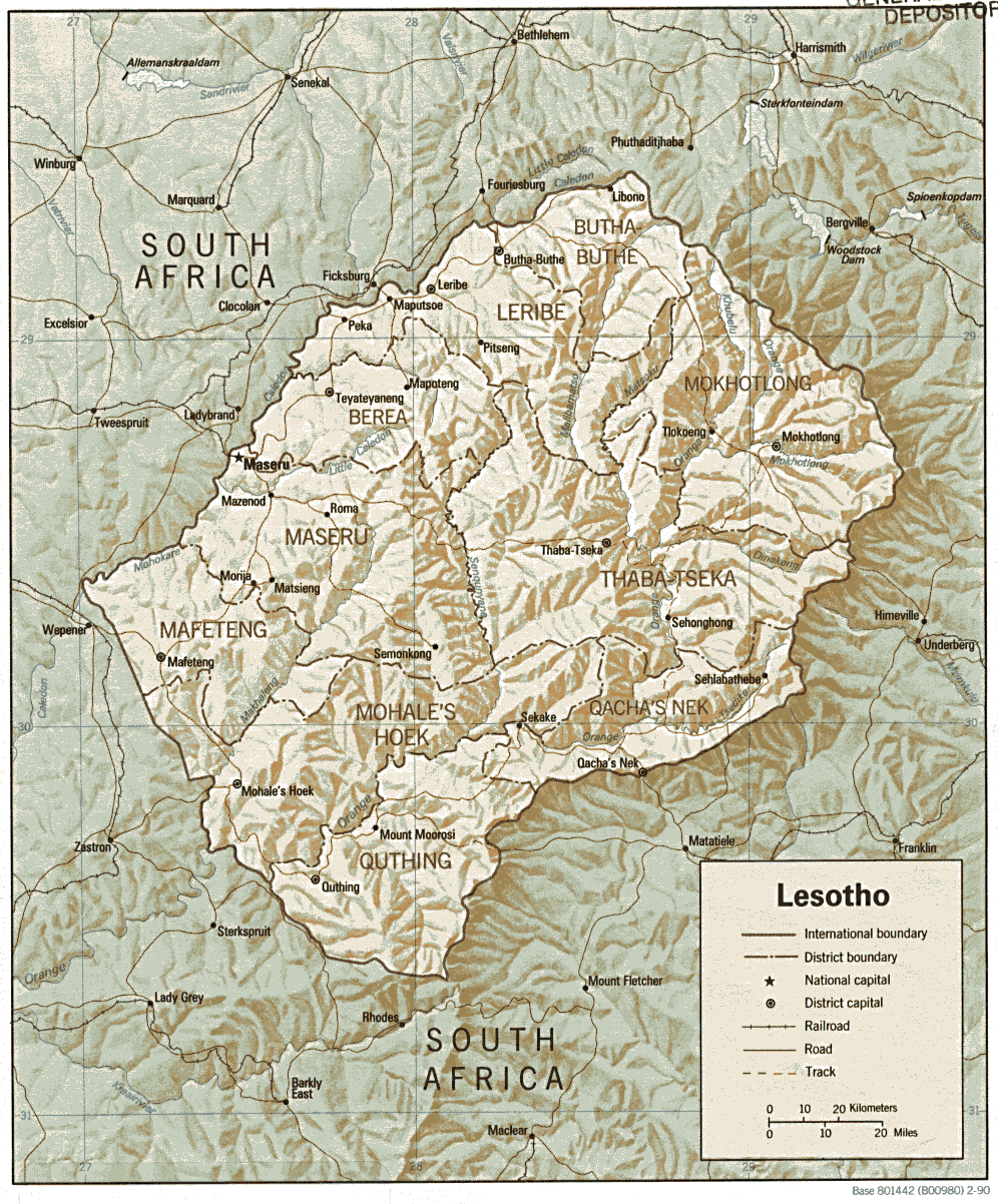
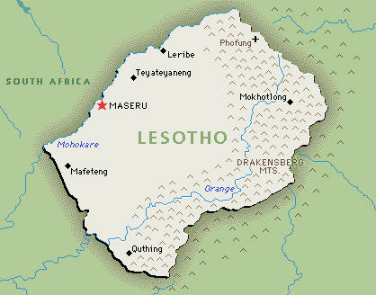
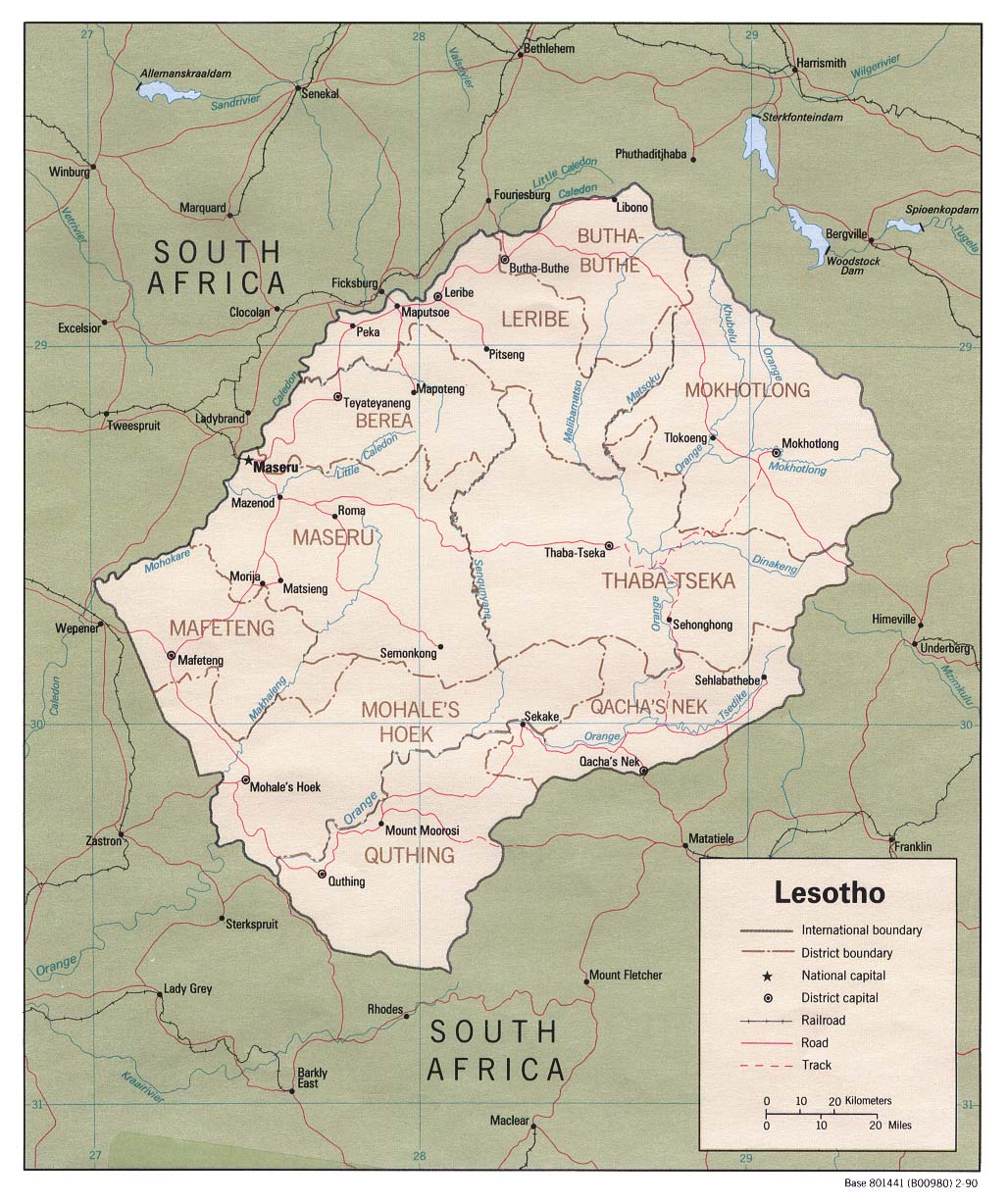
@ Lesotho
@ Relief
@ General
@ Political 1990
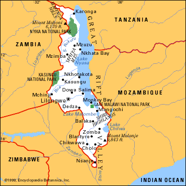
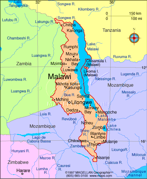
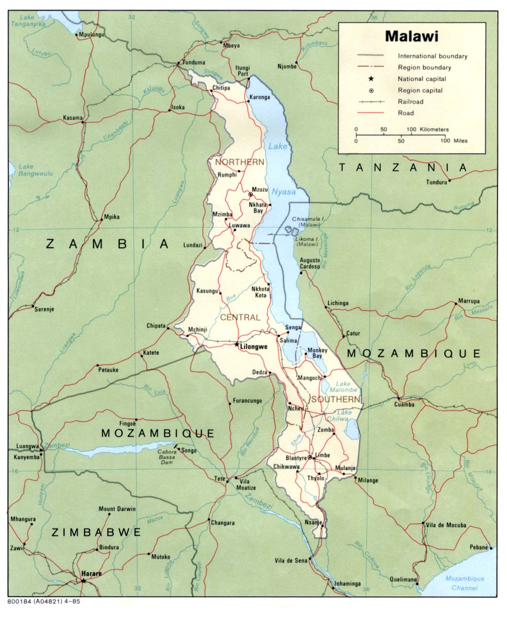
@ Malawi
@ General
@ General
@ Political
@ South
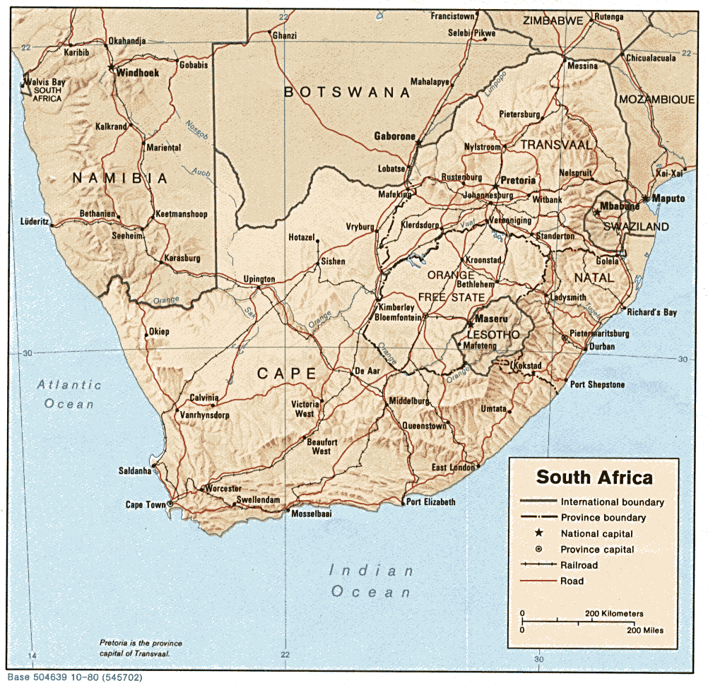
@ Relief
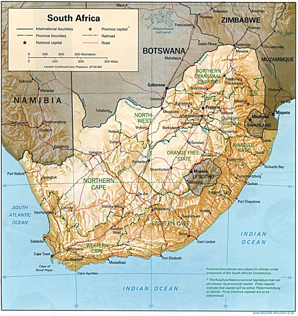
@ General 1995
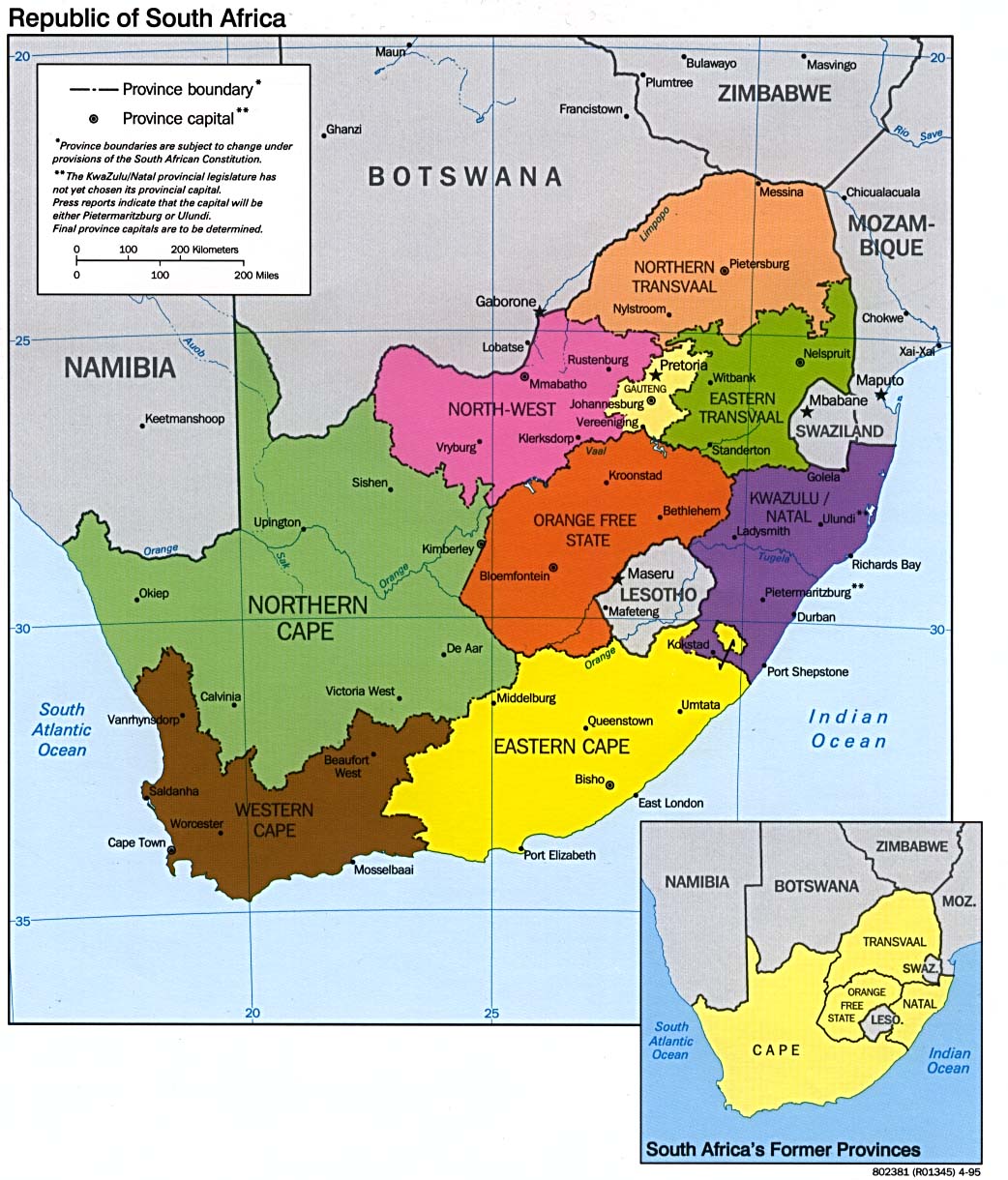
@ Provinces
@ General UN
@ Namibia
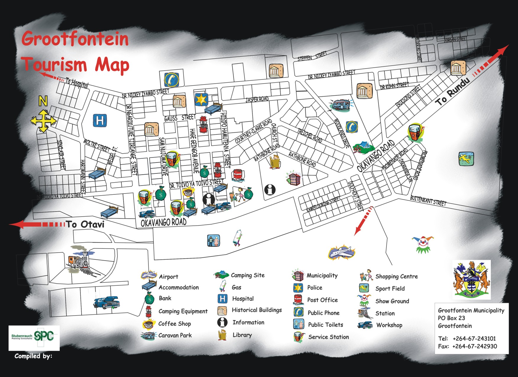
@ Grootfontein
tourist map
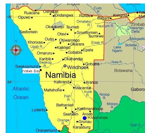
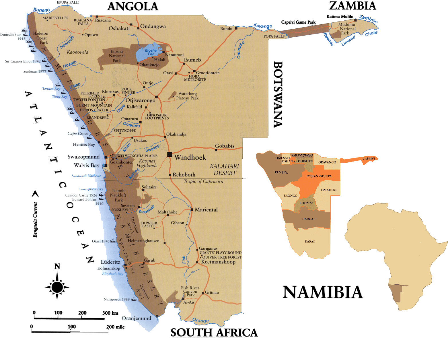
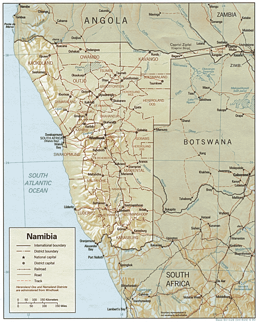
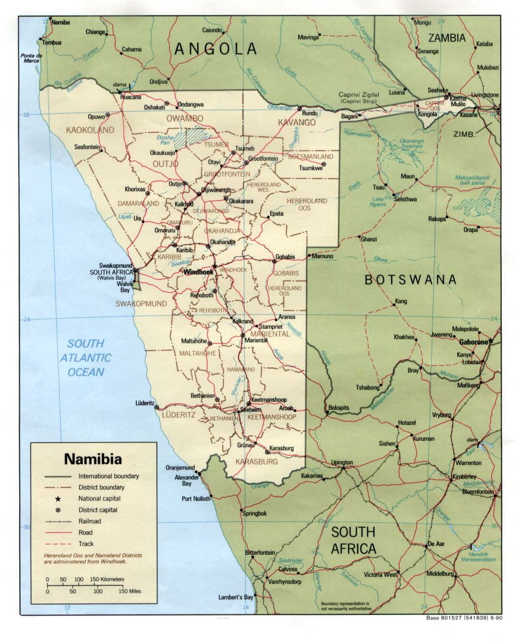
@ Namibia general map
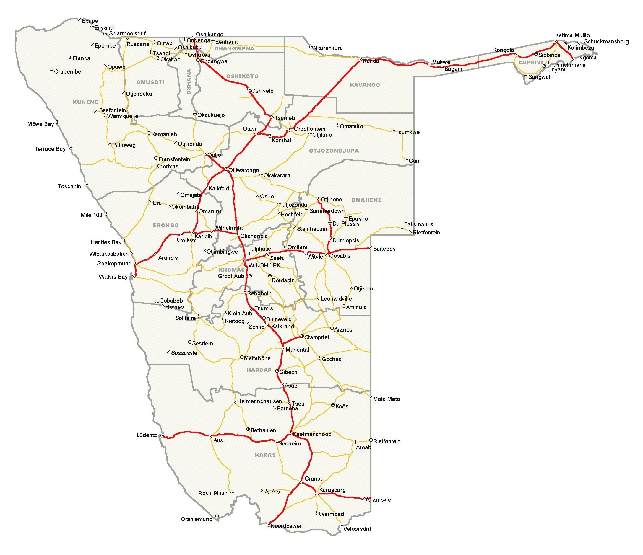
@ Namibia road map
@ Caprivi
@ Coast
@ East
@ Etosha
@ Kaokoland
@ Mariental
@ South
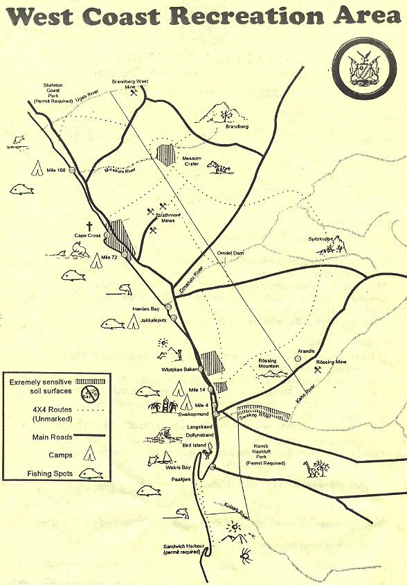
@ West Coast Recreation Area
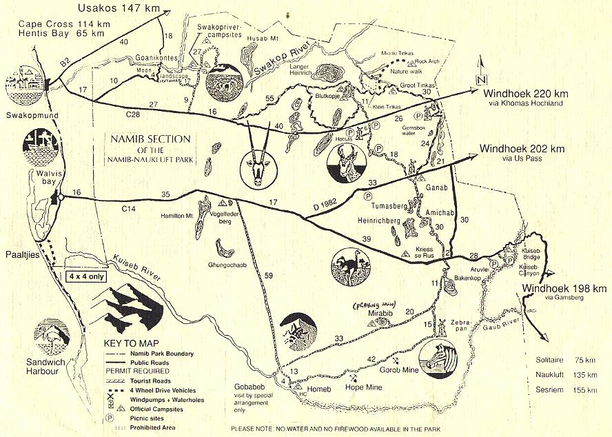
@ Namib Naukluft
Park
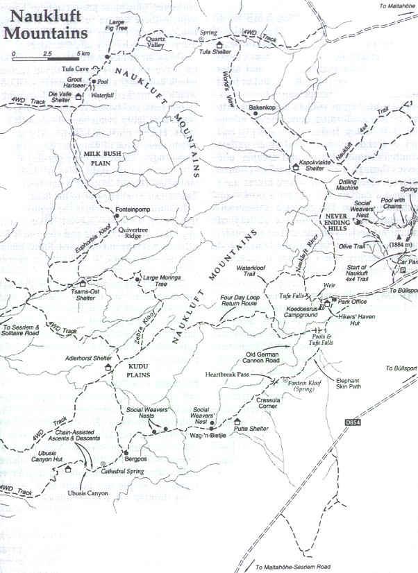
@ Naukluft 4x4 and hiking trails
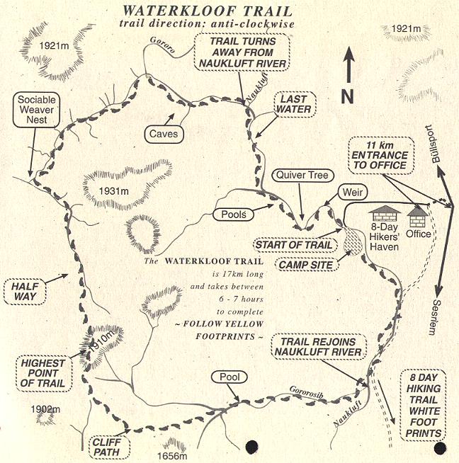
@ Waterkloof
trail
@ Tiras Mountains Conservancy
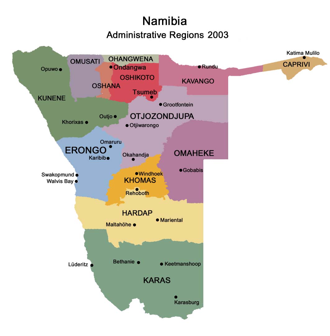
@ Regions in Namibia
@ German map
@ General map
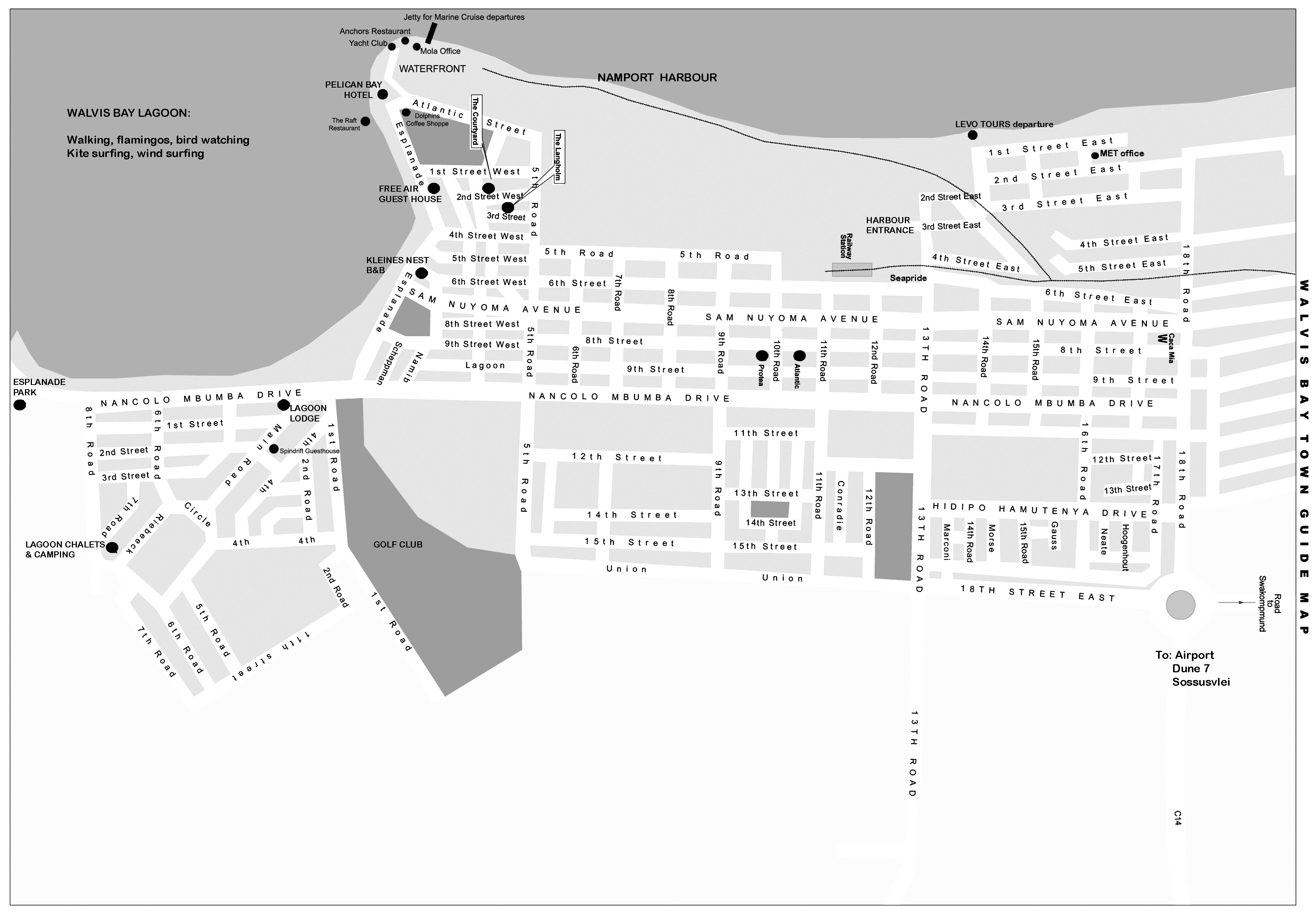
@ Walvis Bay
@ All maps Namibia
Namibia old maps
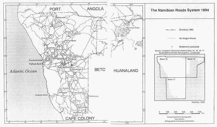
@ Road map 1894
@ Pre-Independence map
@
Walvis Bay political map 1978
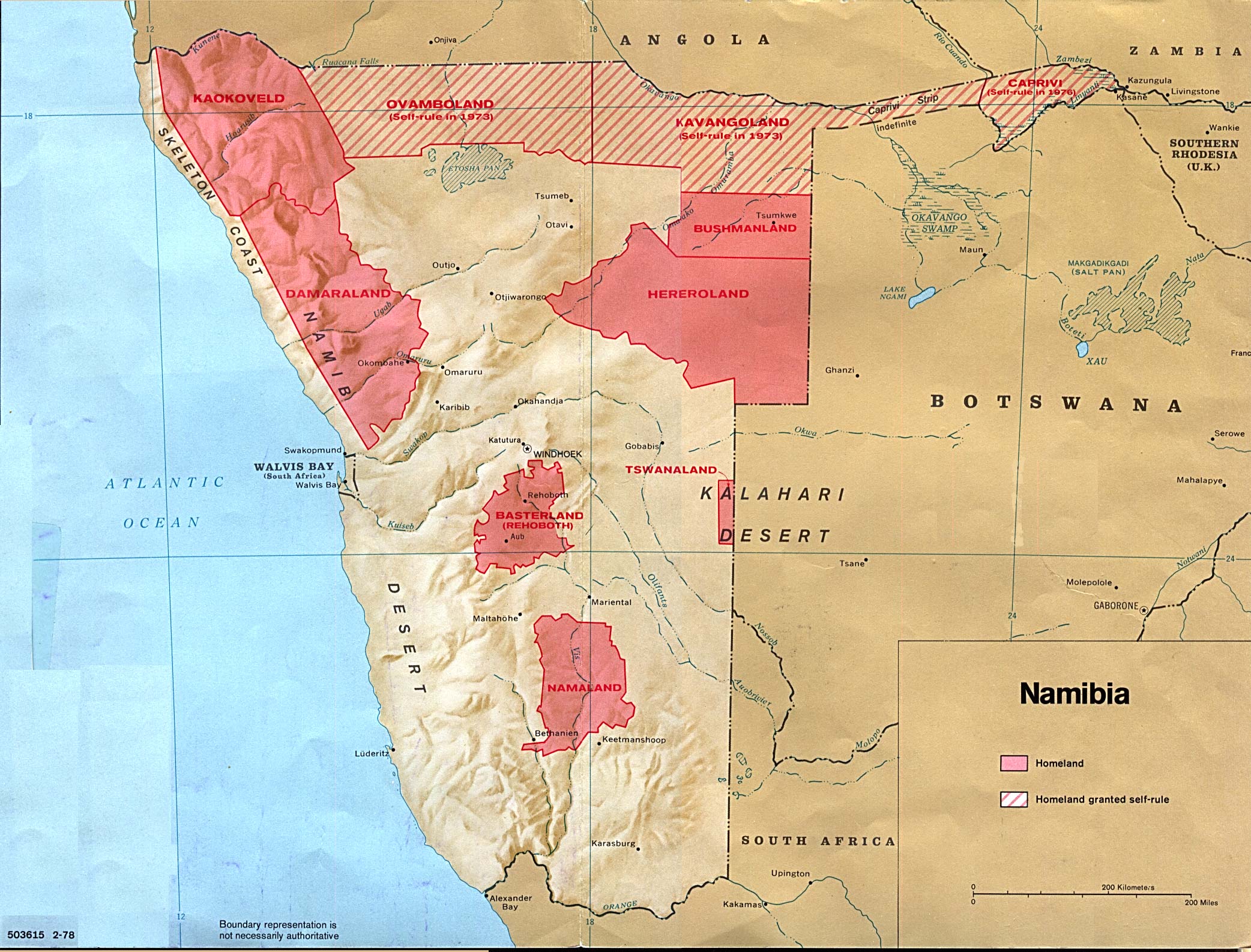
@ Map of homelands 1978
@ Relief map 1990
@ Political map 1990
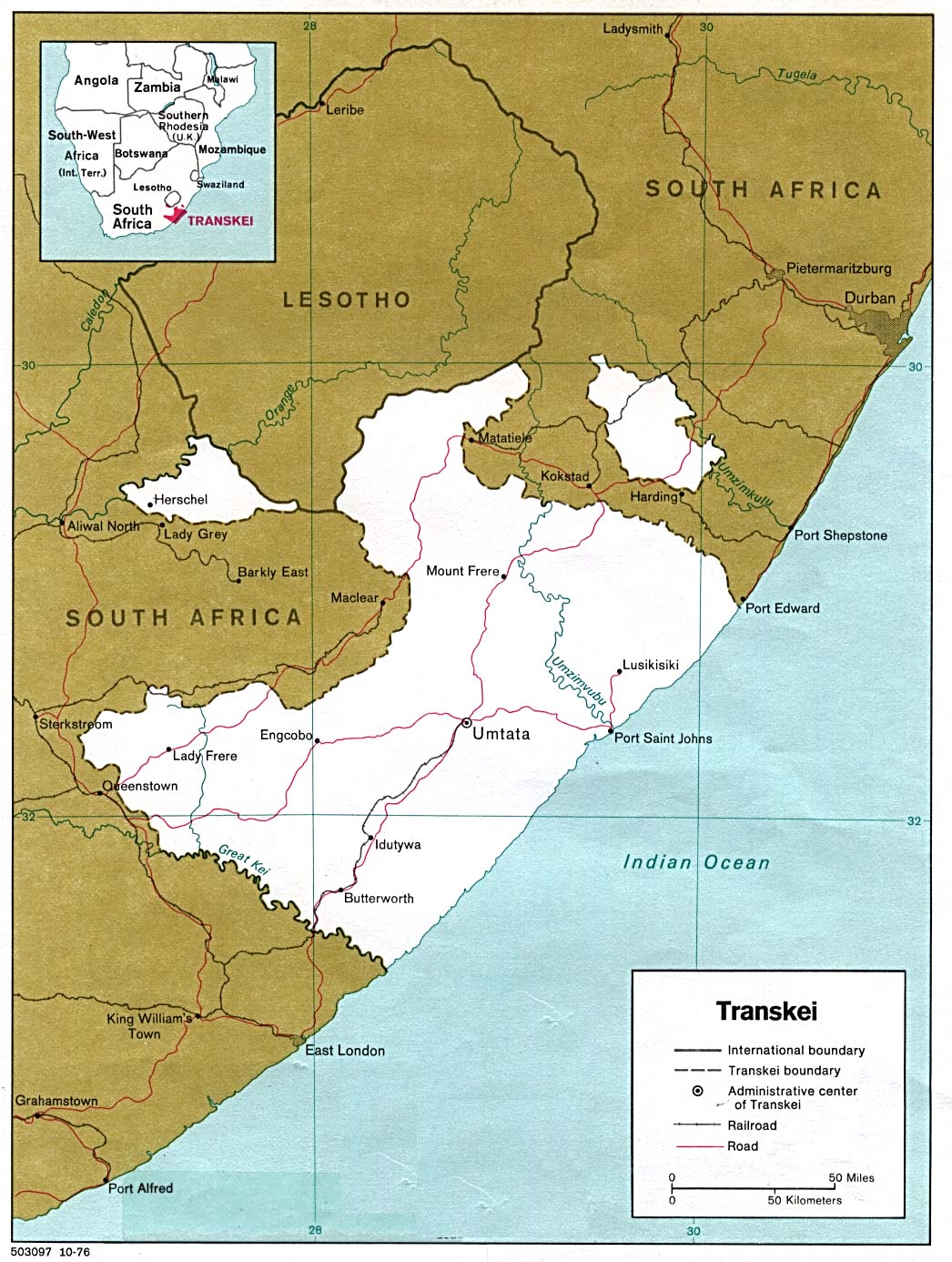
@ Transkei 1978
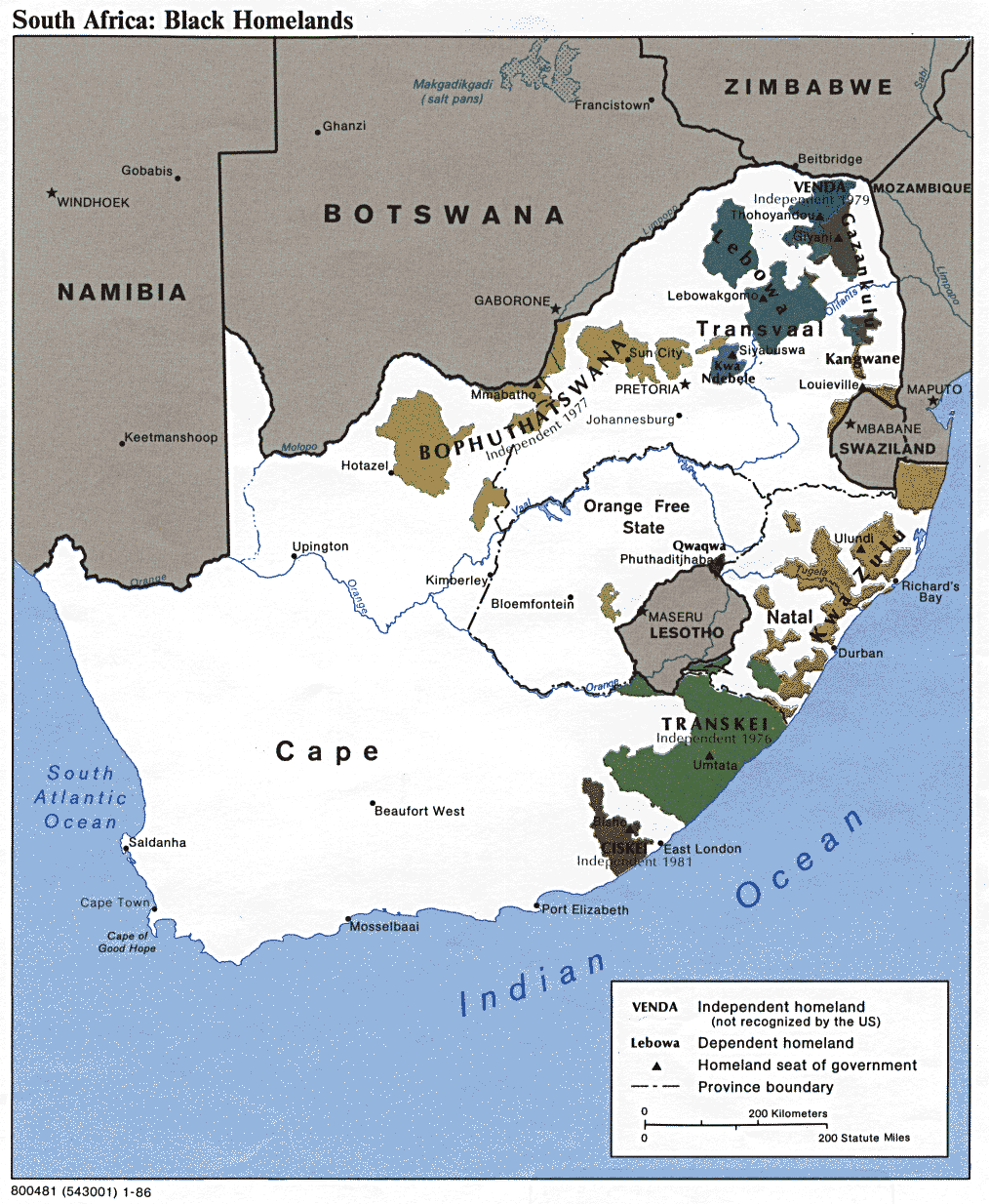
@ Homelands 1986
@ Relief 1995
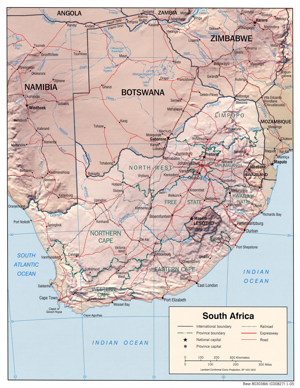
@ Relief 2005
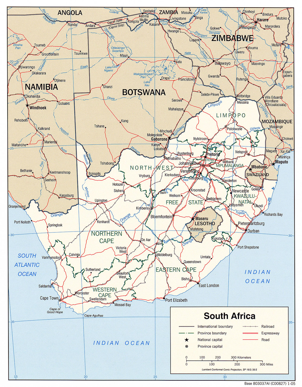
@ Political 2005
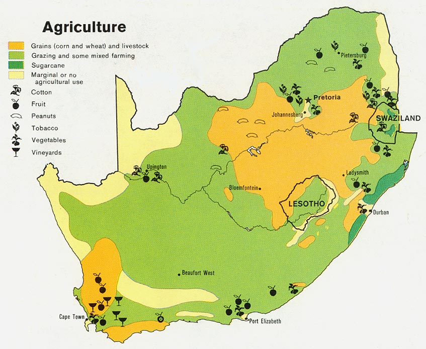
@ Agriculture 1979
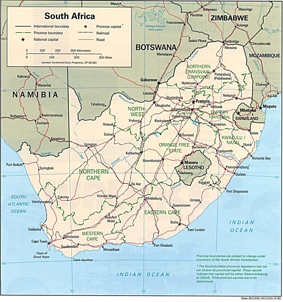
@ Political 1995
@ Political 1980
@ Provinces 1995
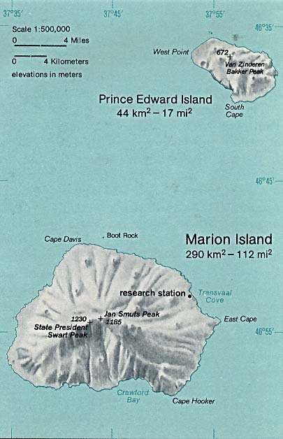
@ Prince Edward Island
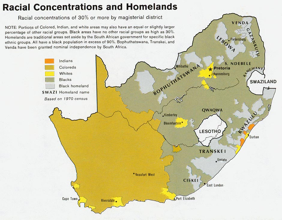
@ Racial 1979
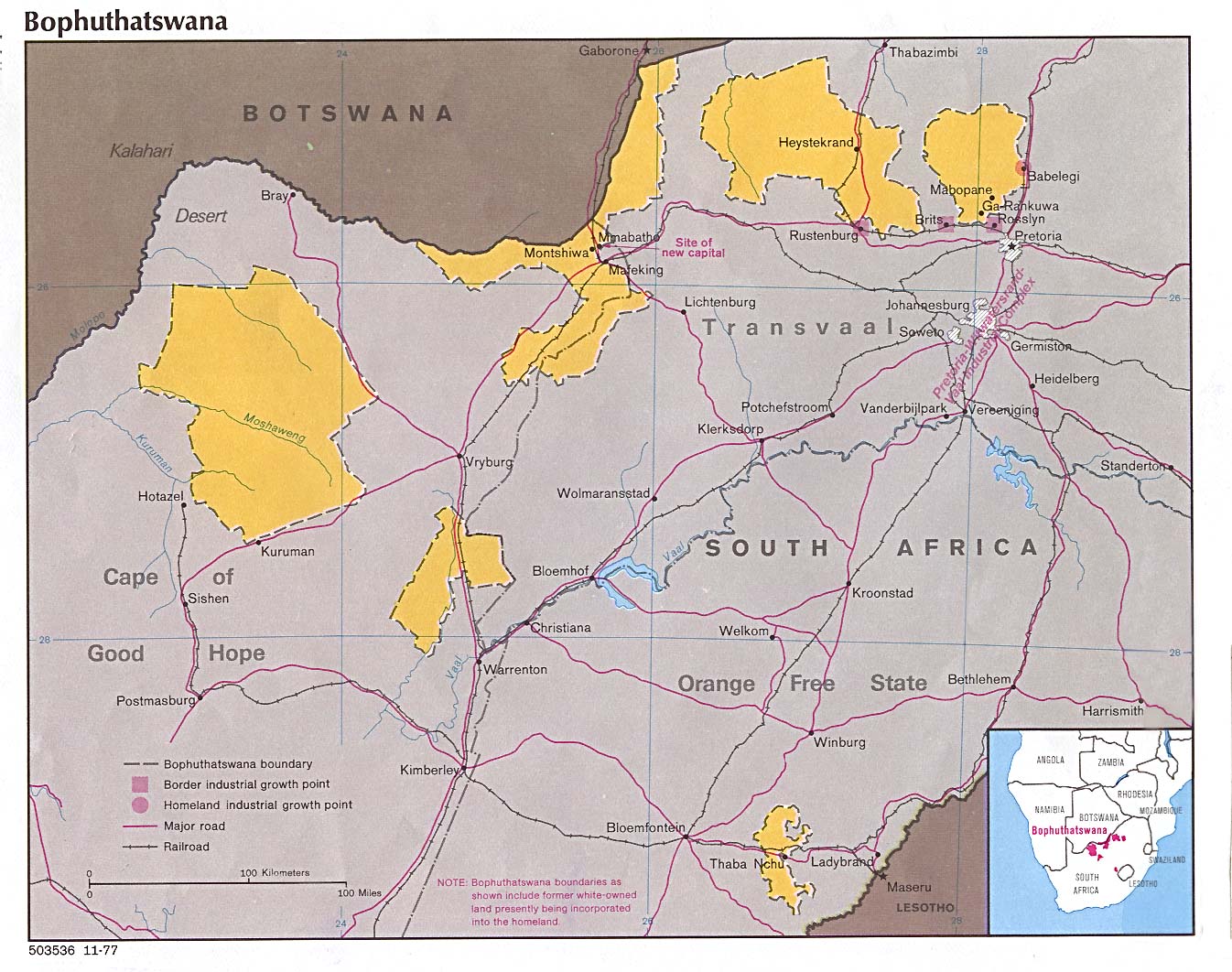
@ Baphuthatswana 1977
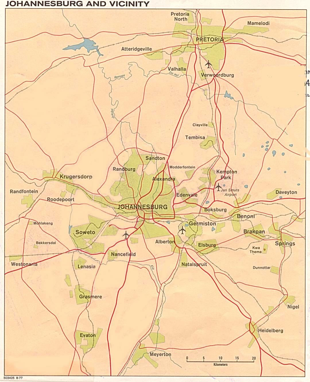
@ Johannesburg 1977
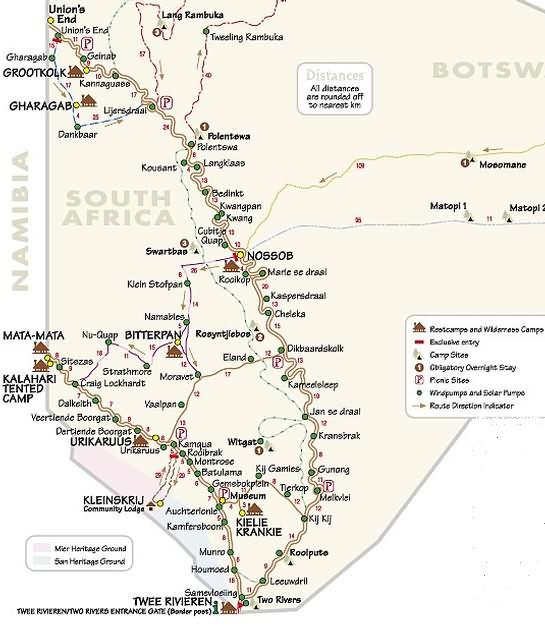
@ Kgalagadi Transfrontier Park
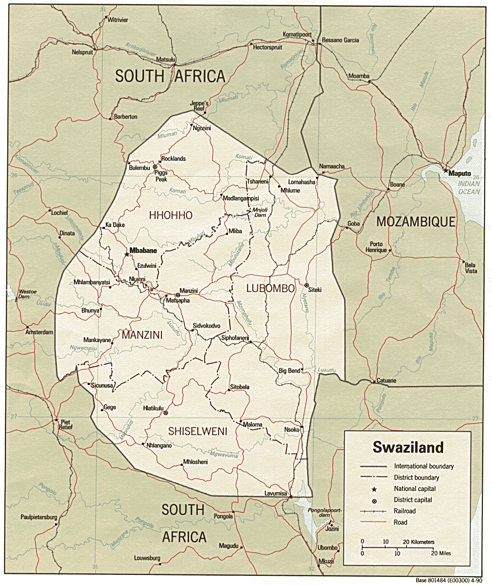
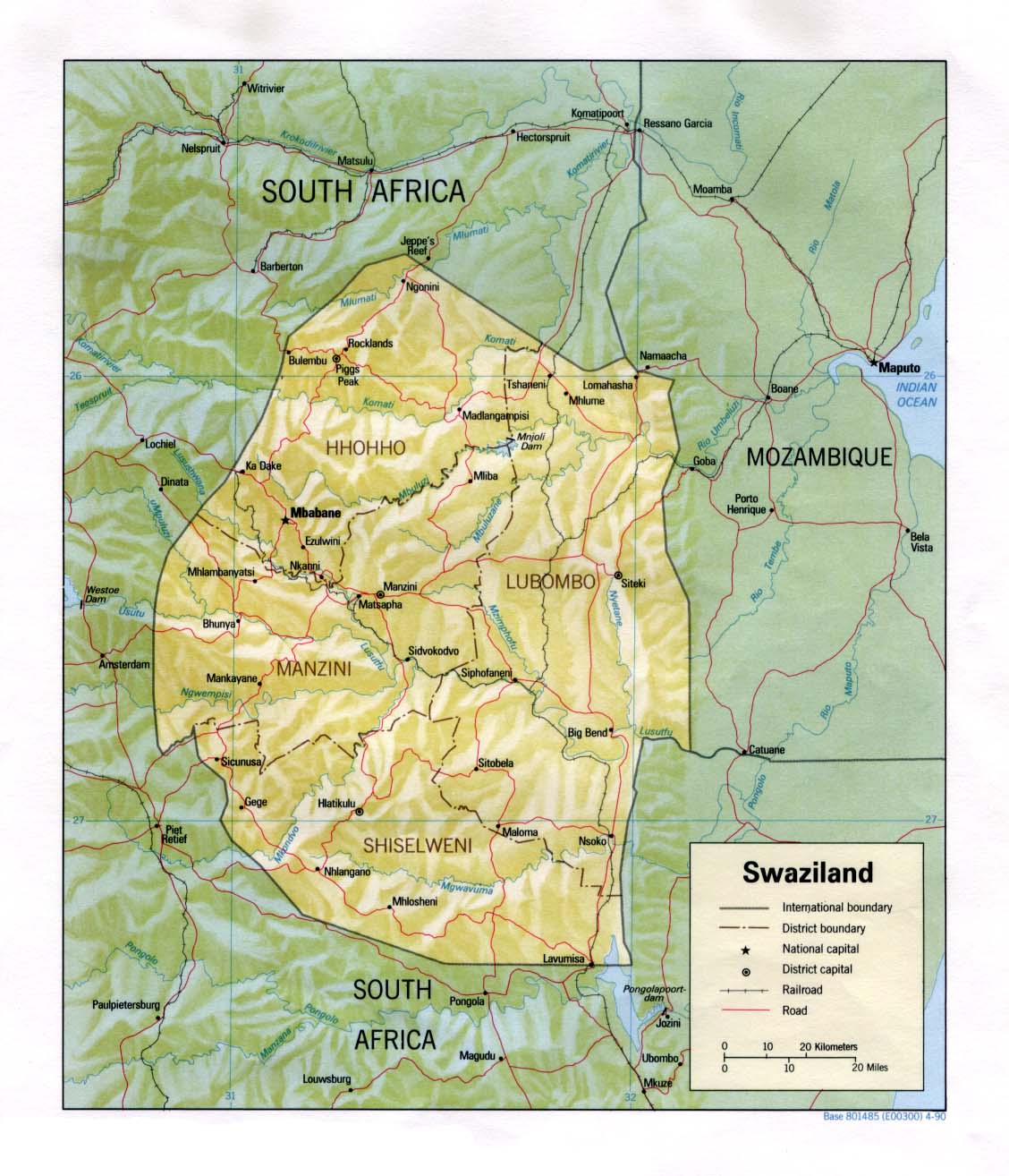
@ Swaziland
@ Political 1985
@ Relief 1990
@ Map of town
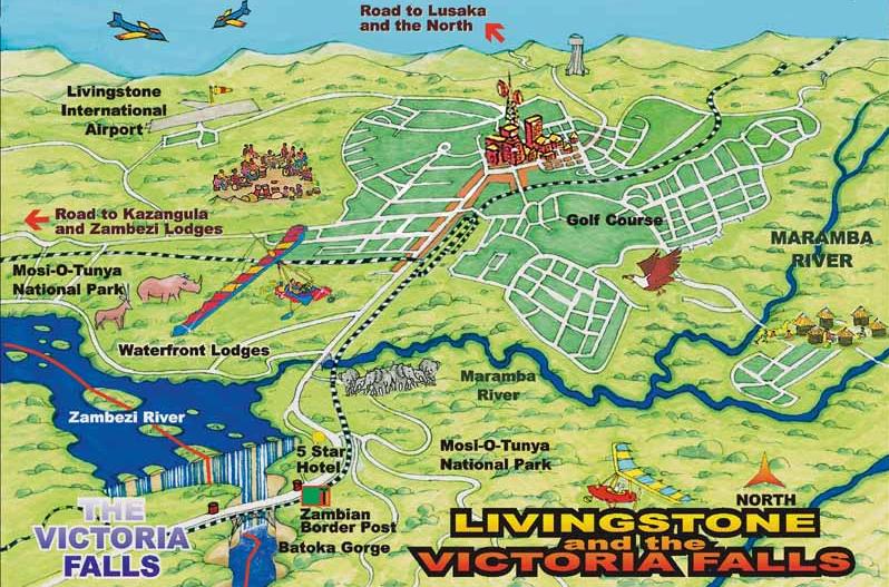
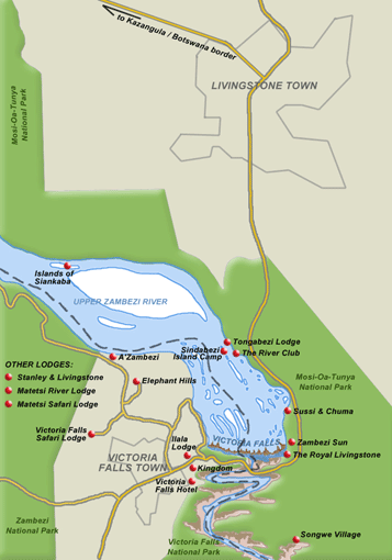
@ Livingstone to Victoria Falls
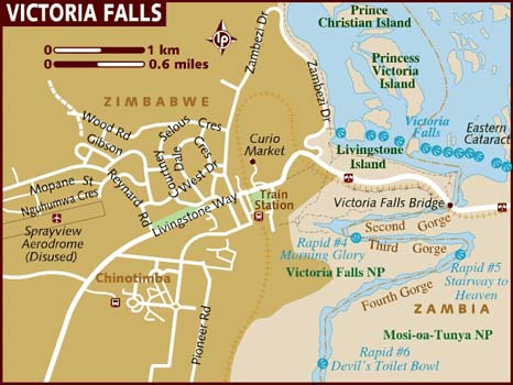
@ Map of Victoria Falls
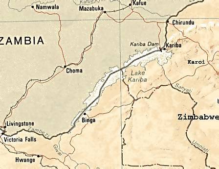
@ Road to Kariba
@ Victoria Falls to Livingstone
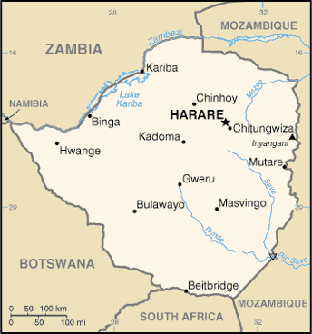
@ Zimbabwe
@ General map
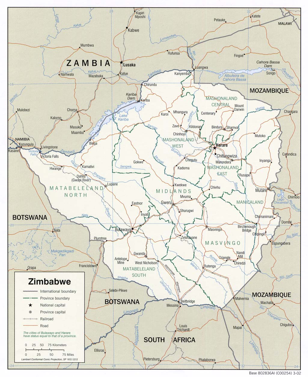
@ Political 2002
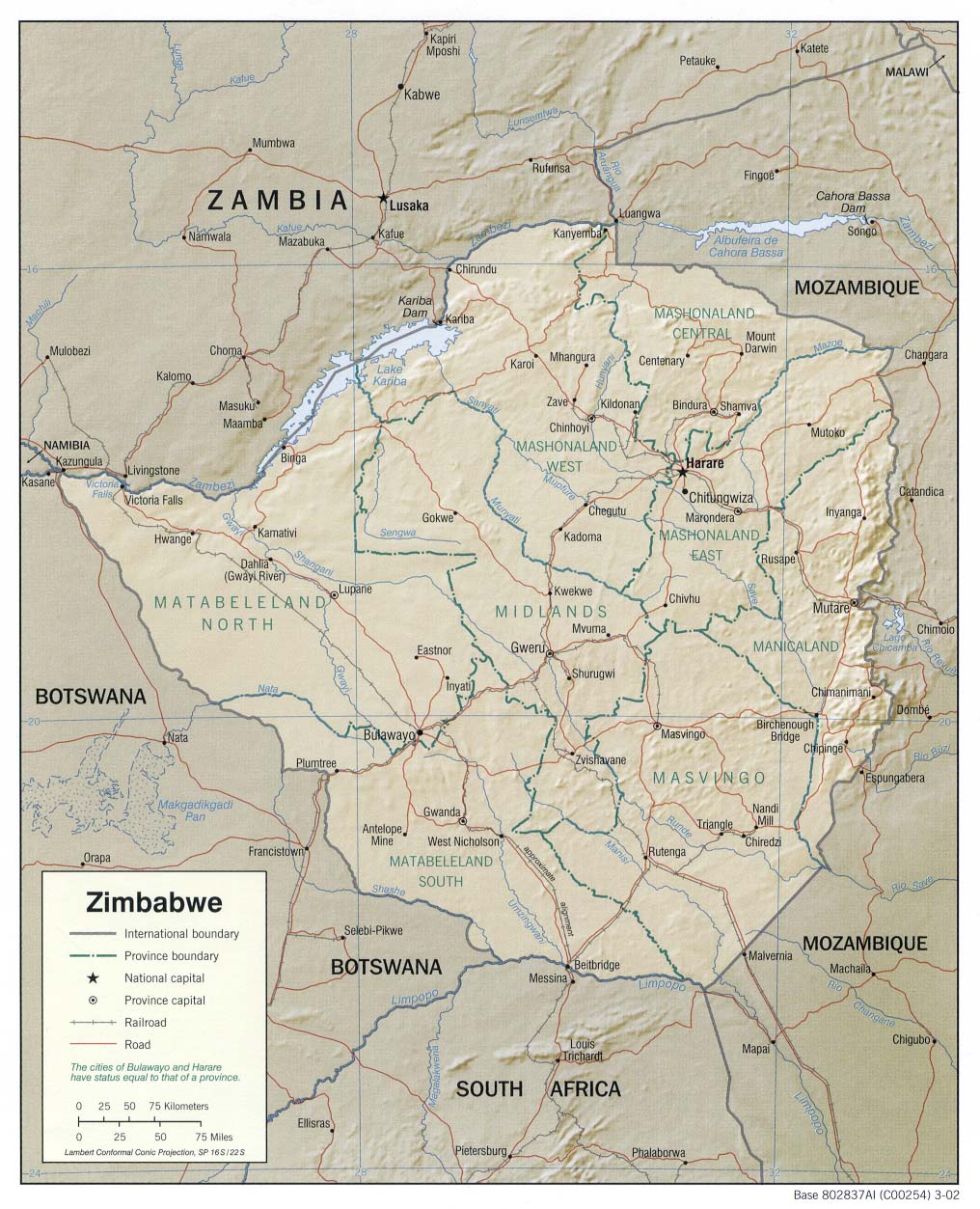
@ Relief 2002
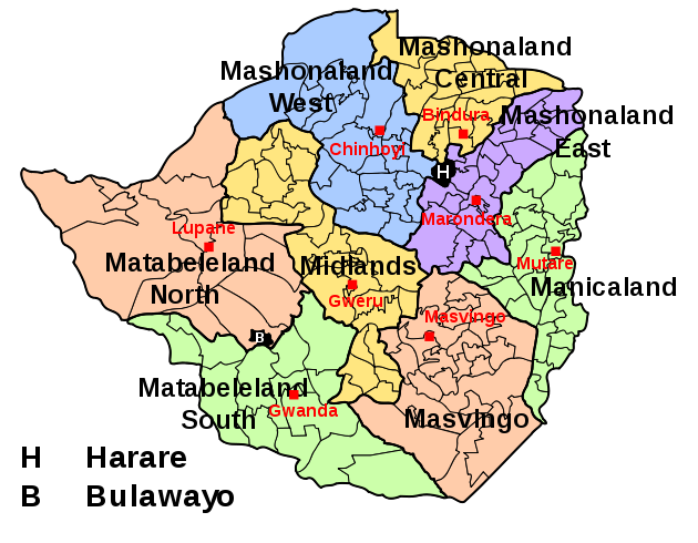
@ Provinces
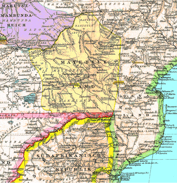
@ Old Matabeleland map
@
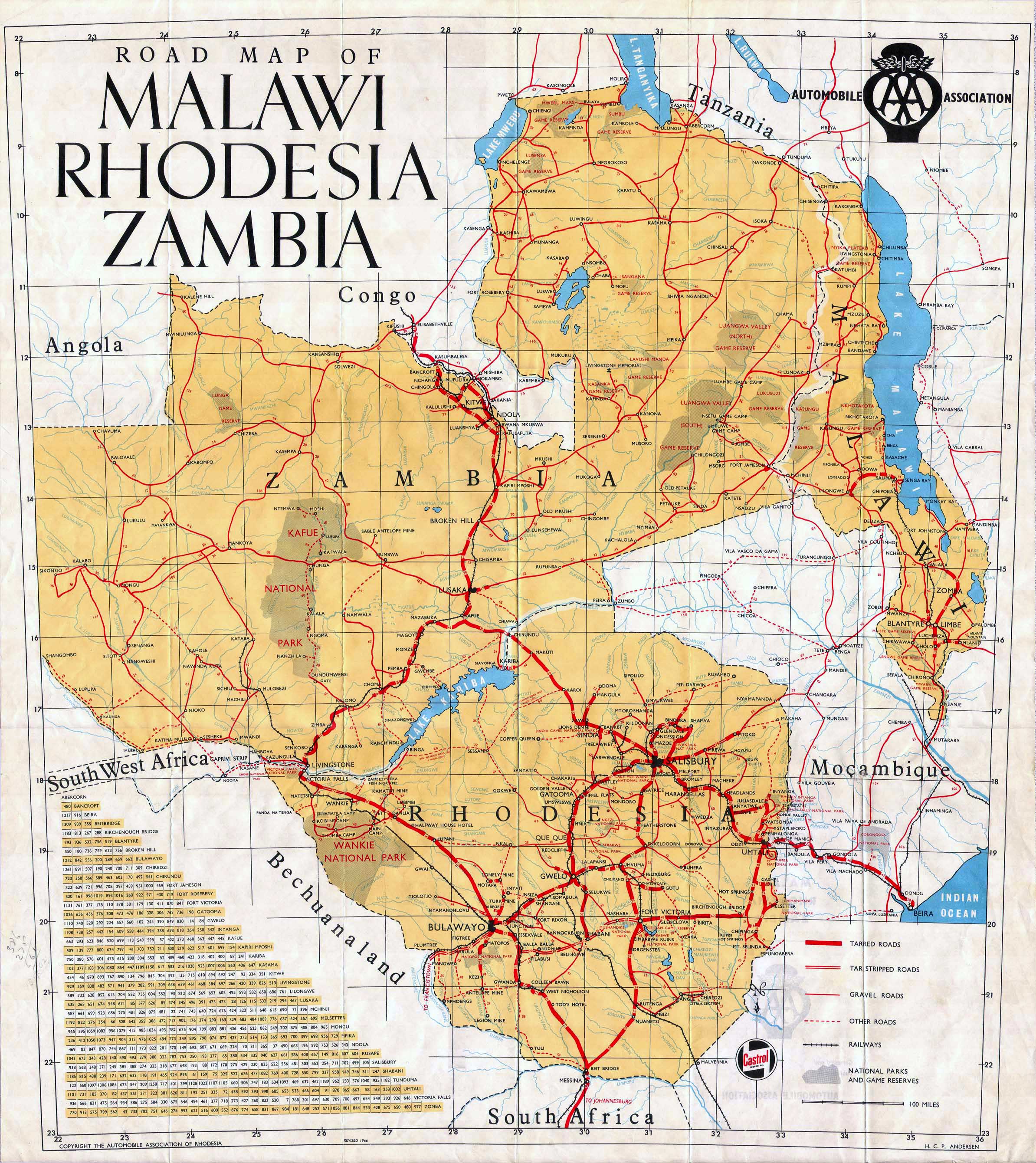
Malawi Rhodesia Zambia: 1966
![]()
![]()
![]()
Page created and serviced by
![]()
www.namibweb.com
Copyright © 1998-2025
namibweb.com - The online guide
to Namibia
All rights reserved |
JOIN
|
VIDEO PORTFOLIO
|
VIDEO/PHOTO COLLECTION
Telegram
| YouTube |
Blog
Page is sponsored by ETS &
Exploring Namibia TV
Disclaimer: no matter how often this page is updated and its accuracy is checked,
www.namibweb.com and ETS
will not be held
responsible for any change in opinion, information, facilities, services,
conditions, etc. offered by
establishment/operator/service/information provider or any third party