LINKS TO PAGES WITH MAPS
TOWNS
@ Windhoek
#
Windhoek city walk route map
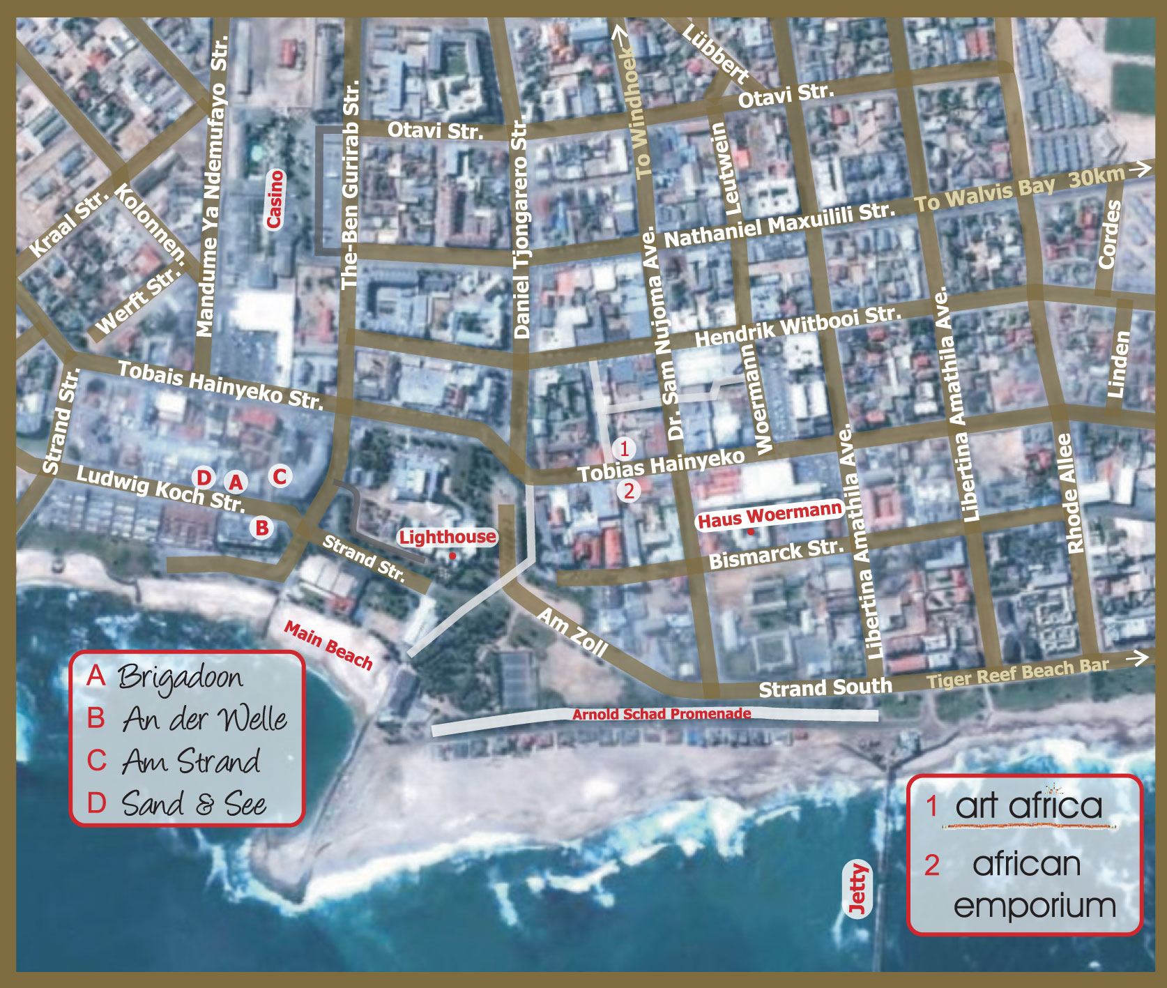
@ Swakopmund
# Map of town
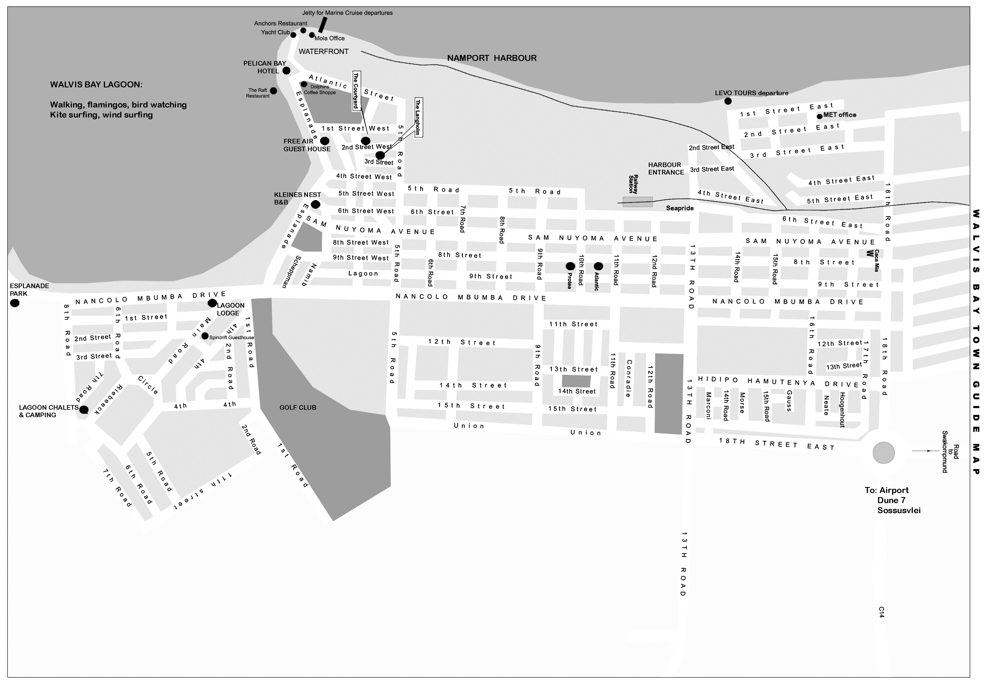
@ Walvis Bay
# Walvis Bay
@ Mariental
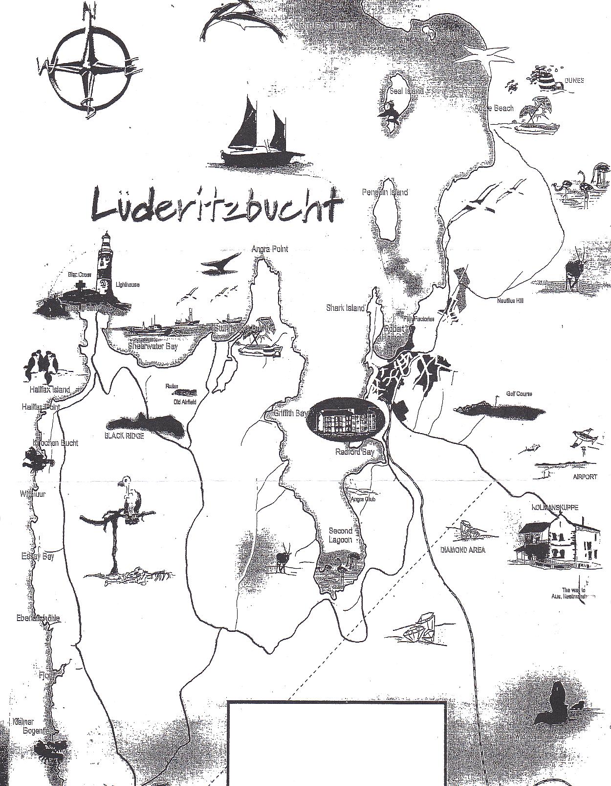
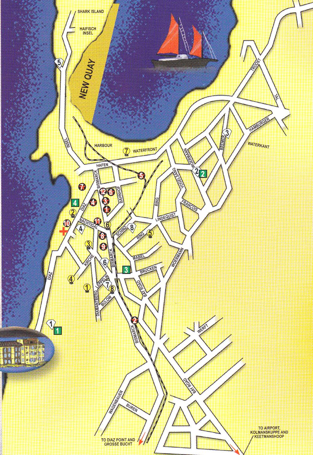
@ Luderitz
# Luderitz surroundings
# Town map
@ Gobabis
# Gobabis town map
@ Henties Bay
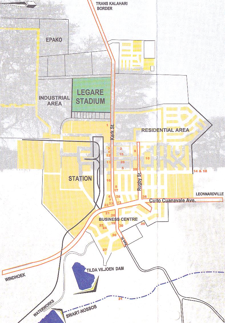
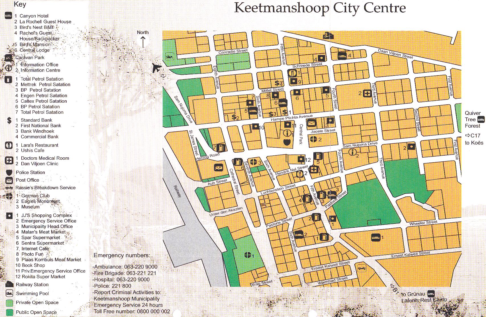
@ Keetmanshoop
# Town center
@ Otjiwarongo
@ Tsumeb
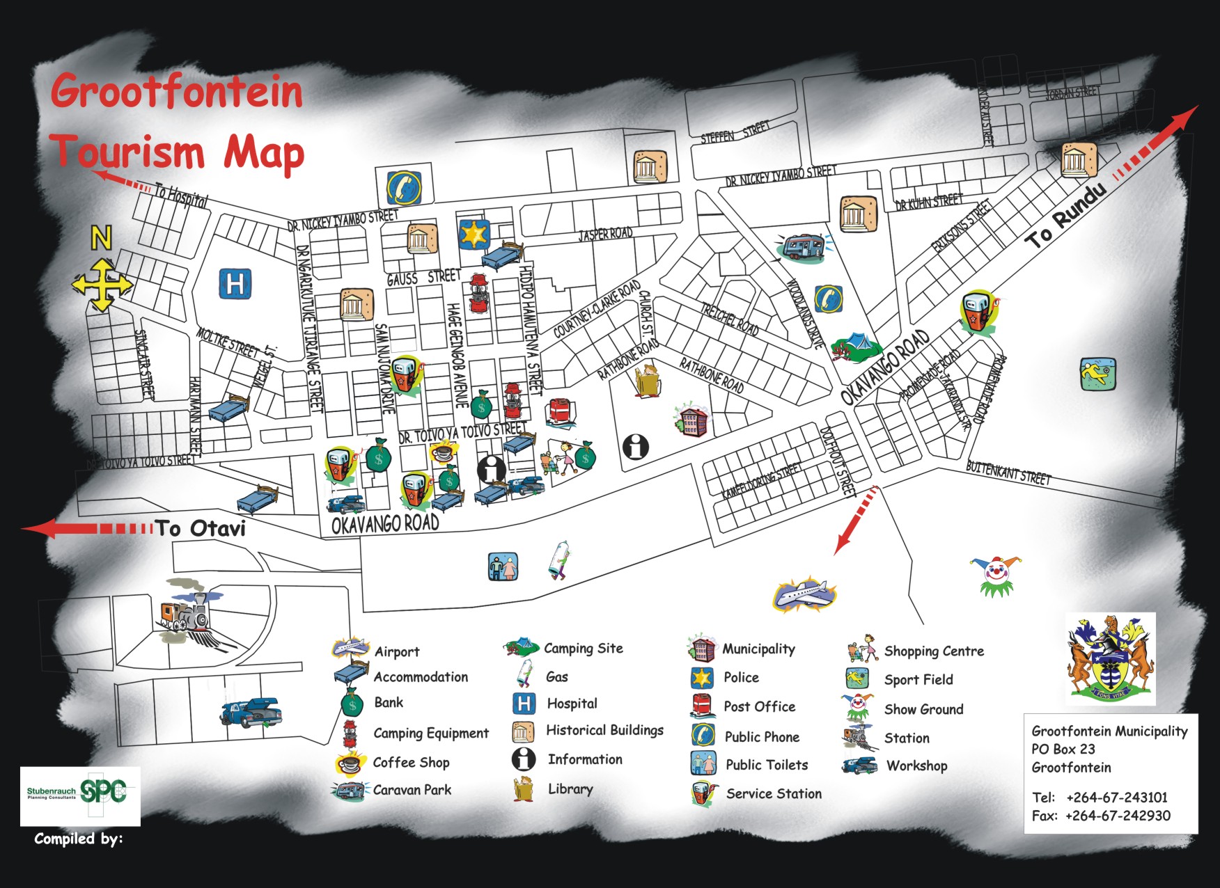
@ Grootfontein
tourist map
COUNTRY MAPS
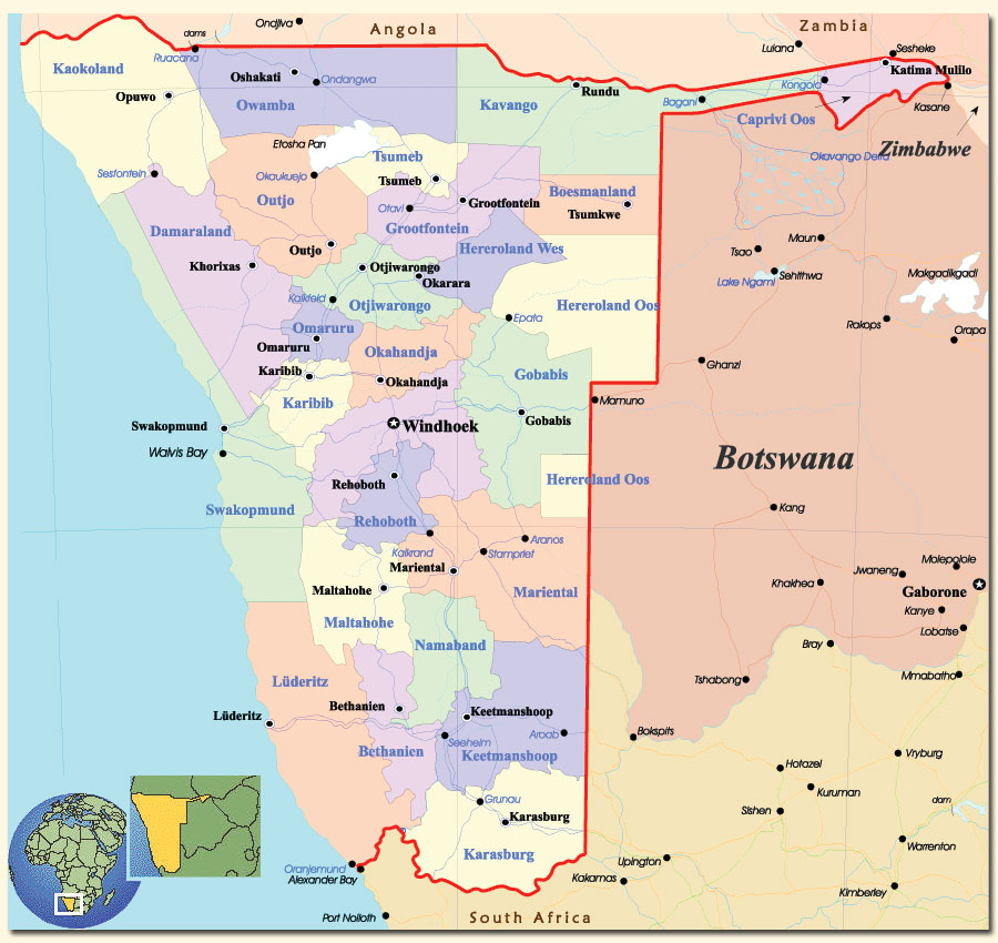
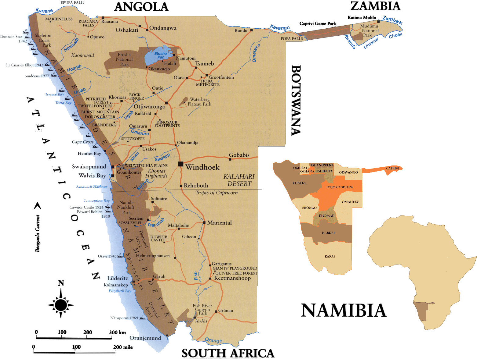
@ Namibia
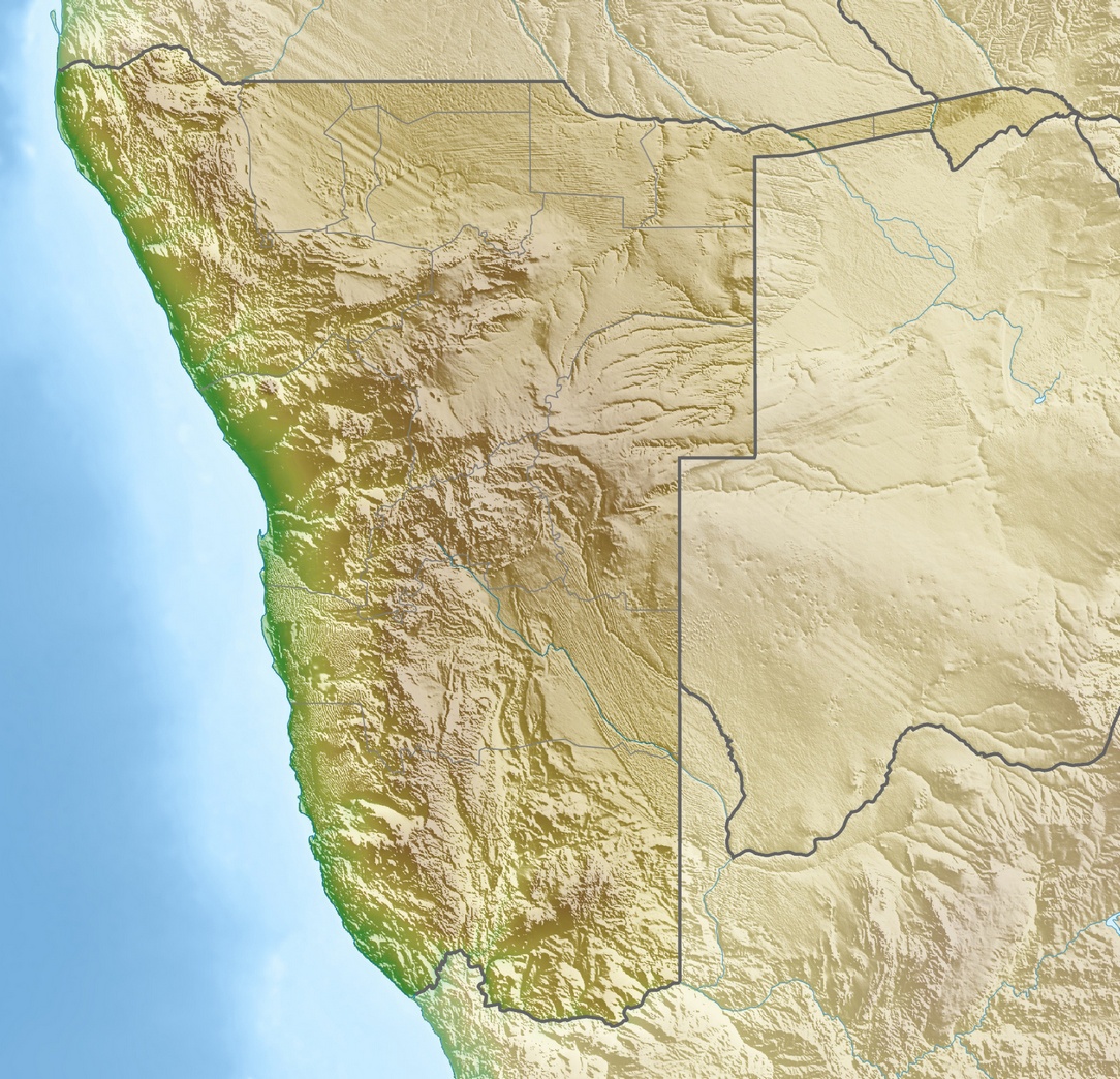
@ Namibia relief map
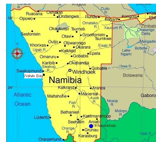
@ Namibia general map
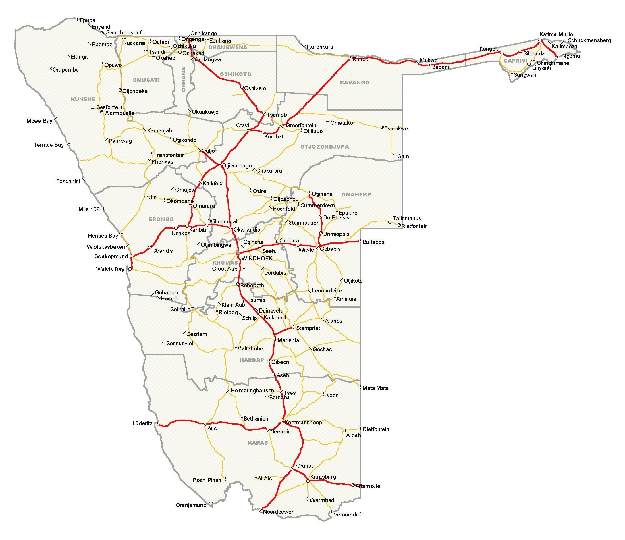
@ Namibia road map
@ Caprivi
@ Coast
@ East
@ Kaokoland
@ Mariental & East
@ South
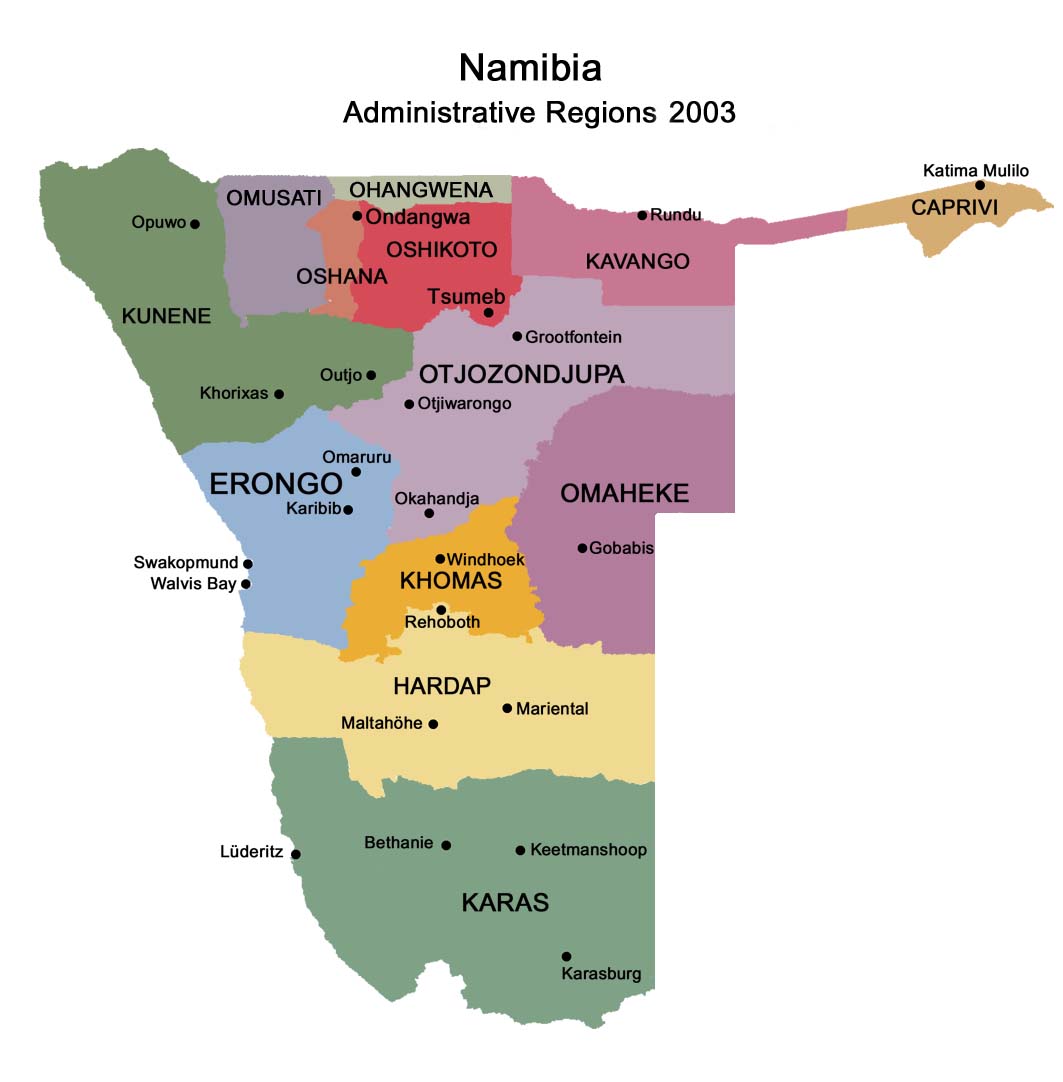
@ Regions in Namibia
@ German map
@ General map
@
Russian map
NATIONAL PARKS
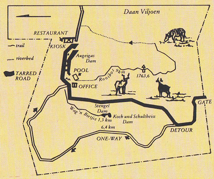
@ Daan Viljoen Park
# Daan Viljoen Park map &
camp plan
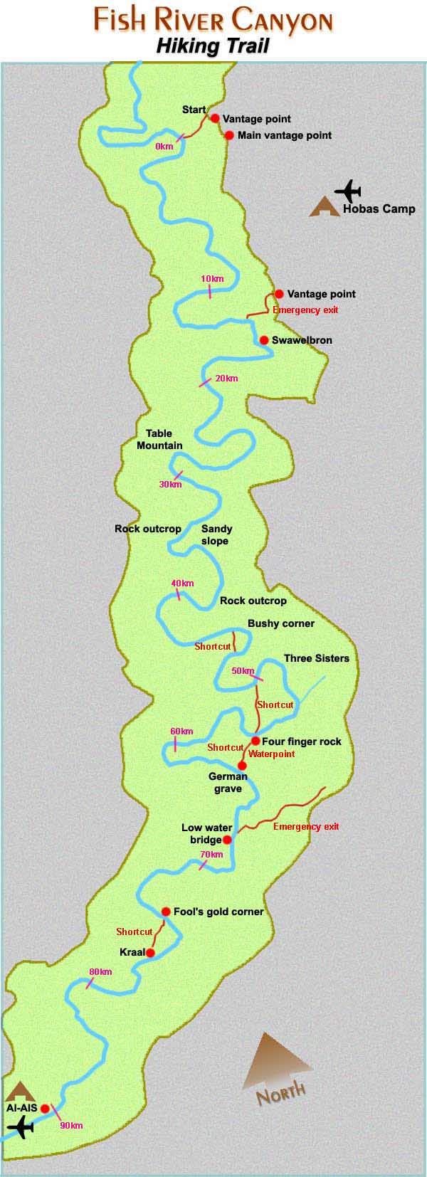
@ Fish River Canyon
hiking trail
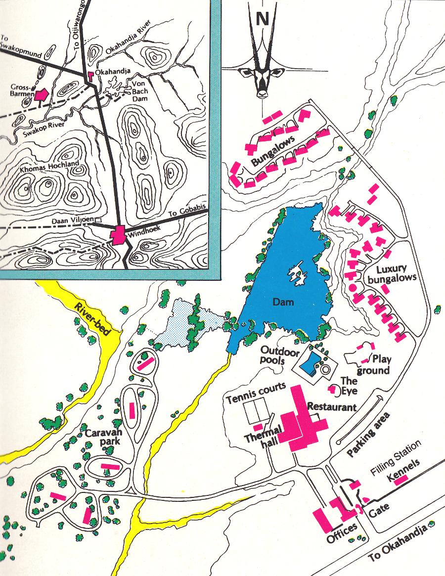
@ Gross Barmen
Resort
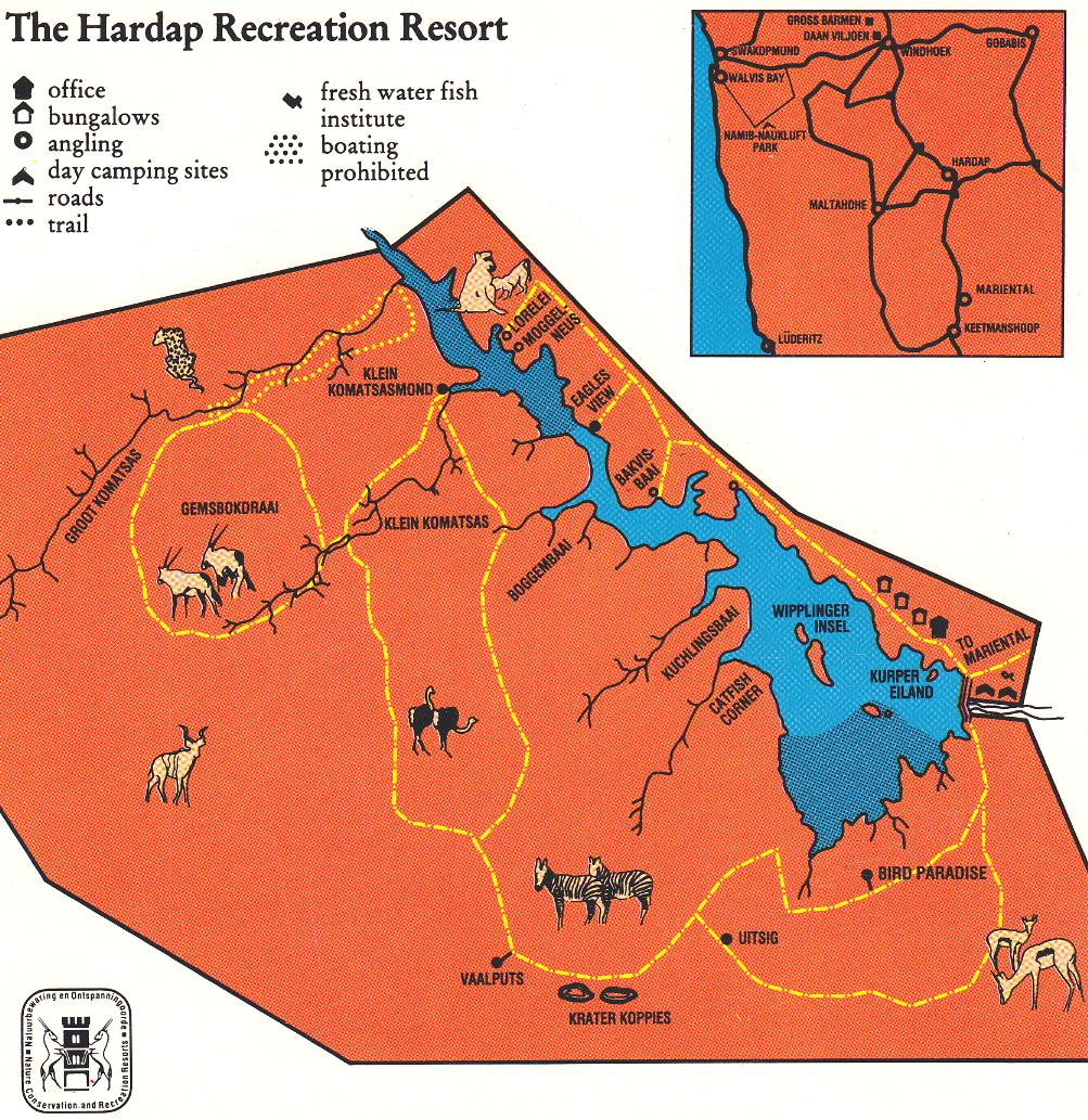
@ Hardap Resort
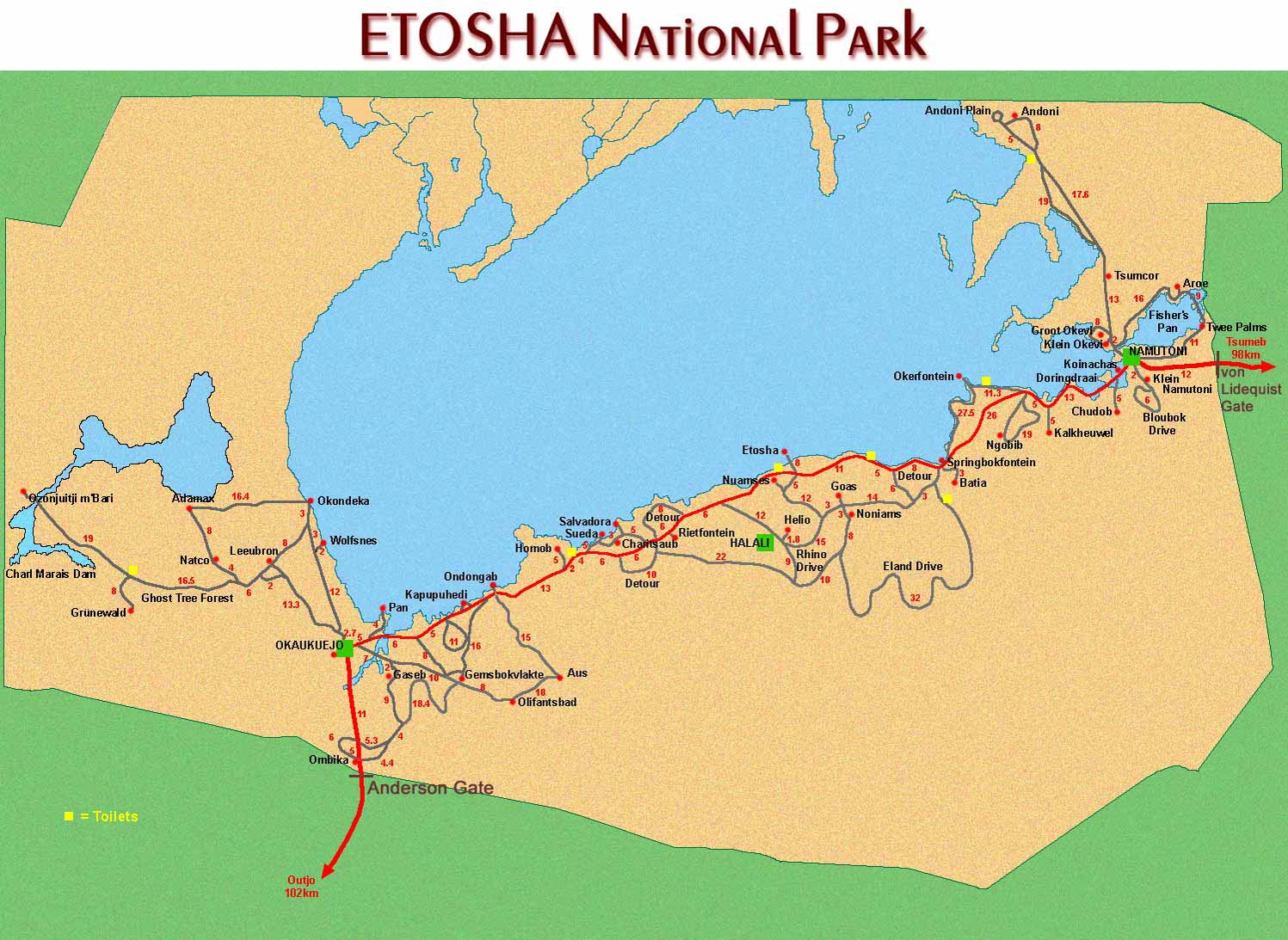
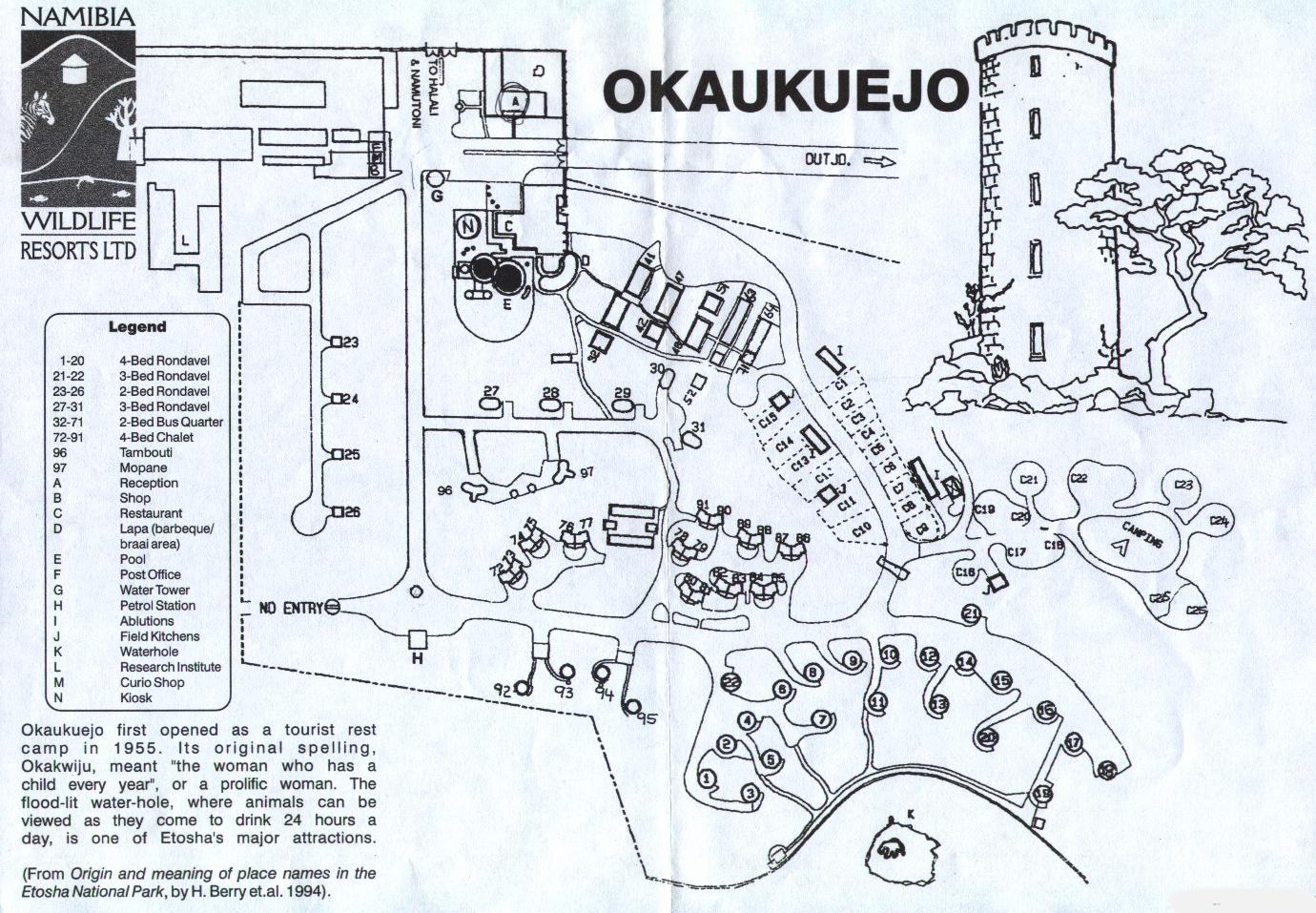
@ Etosha National Park
@ Etosha
#
Plan of Okaukuejo Camp
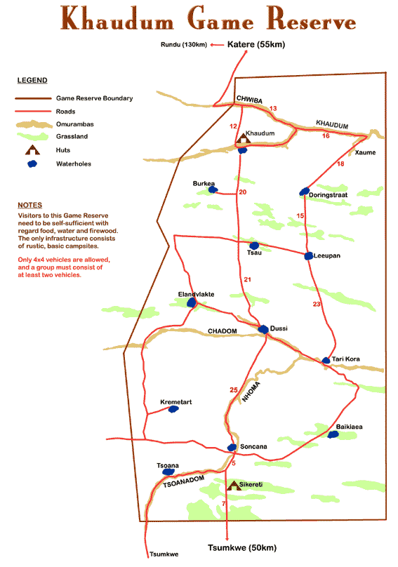
@ Khaudum Game
Reserve
@ Mangetti National Park
@ Namib Naukluft Park
# General map
#
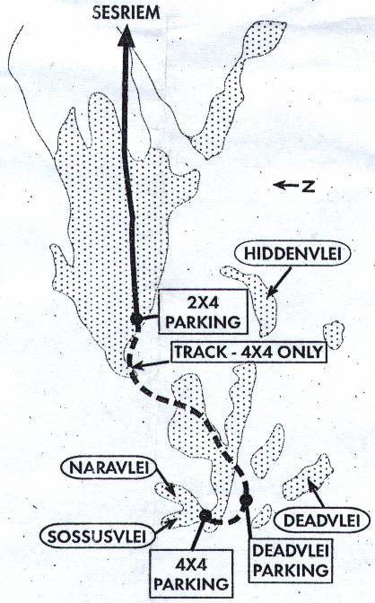
Map of
Dead Vlei/Sossusvlei
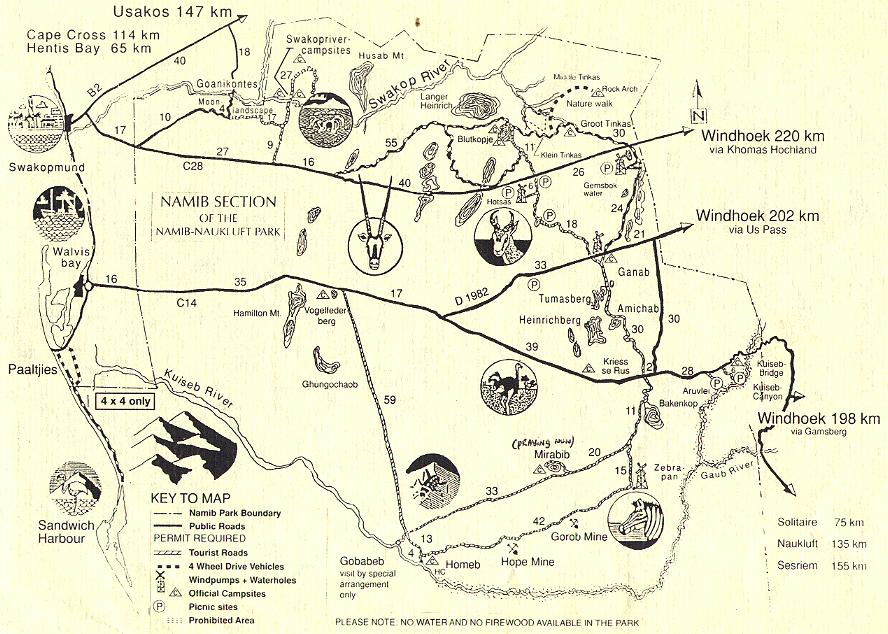
# Namib
section of Namib Naukluft
Park
# Namib section
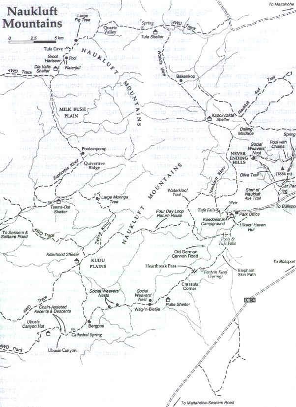
# Naukluft 4x4 and hiking trails
# Naukluft hiking trail
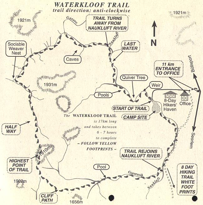
# Waterkloof
trail
# Namib-Naukluft Park: Olive
& Waterkloof hiking trails
@ Namib
Naukluft Park - camp sites
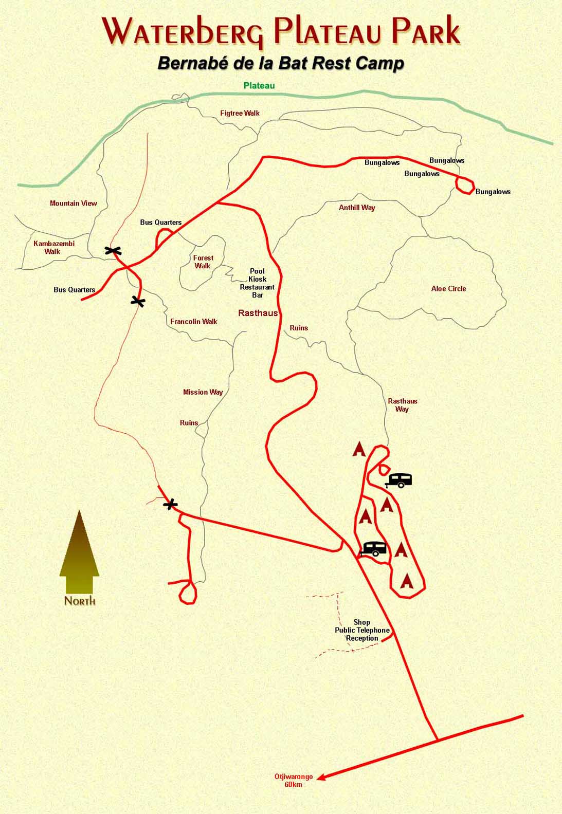
@ Waterberg Park:
Bernabe de la Bat Camp
@
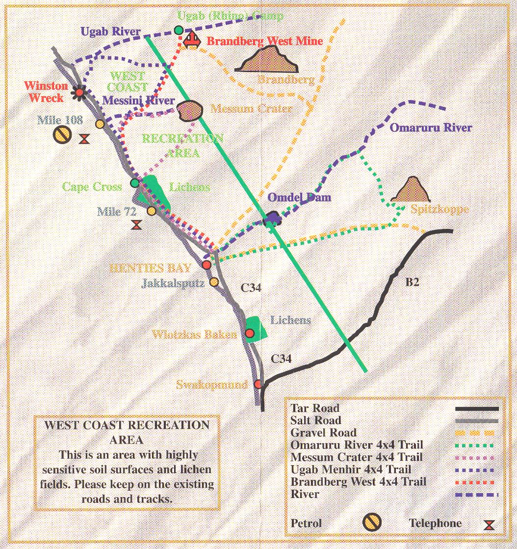
West Coast Recreation Area &
4x4 trails
@ Skeleton Coast
Park
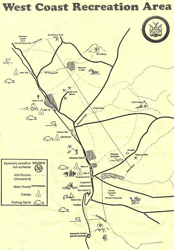
@ West Coast Recreation Area
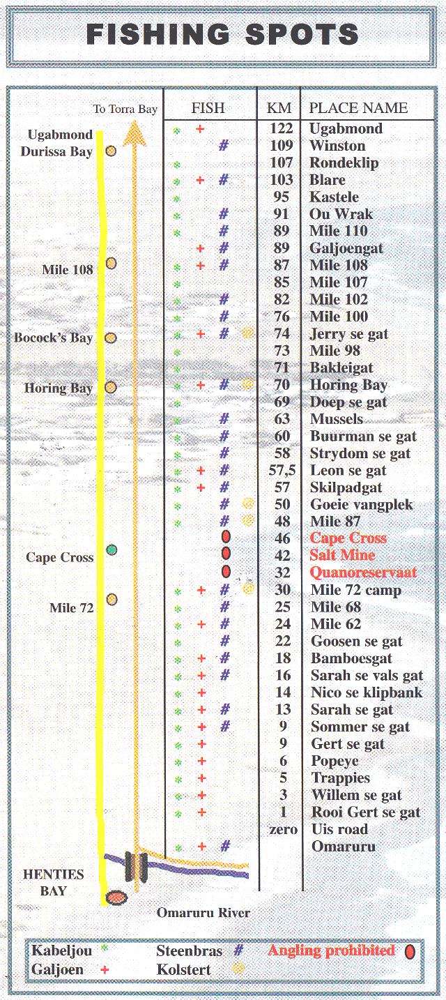
# Fishing spots
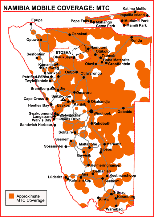
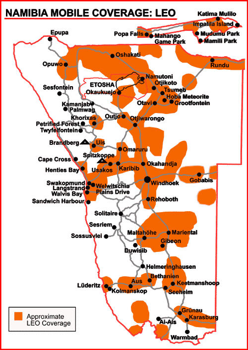
MOBILE COVERAGE
OTHERS
@ Tiras Mountains Conservancy
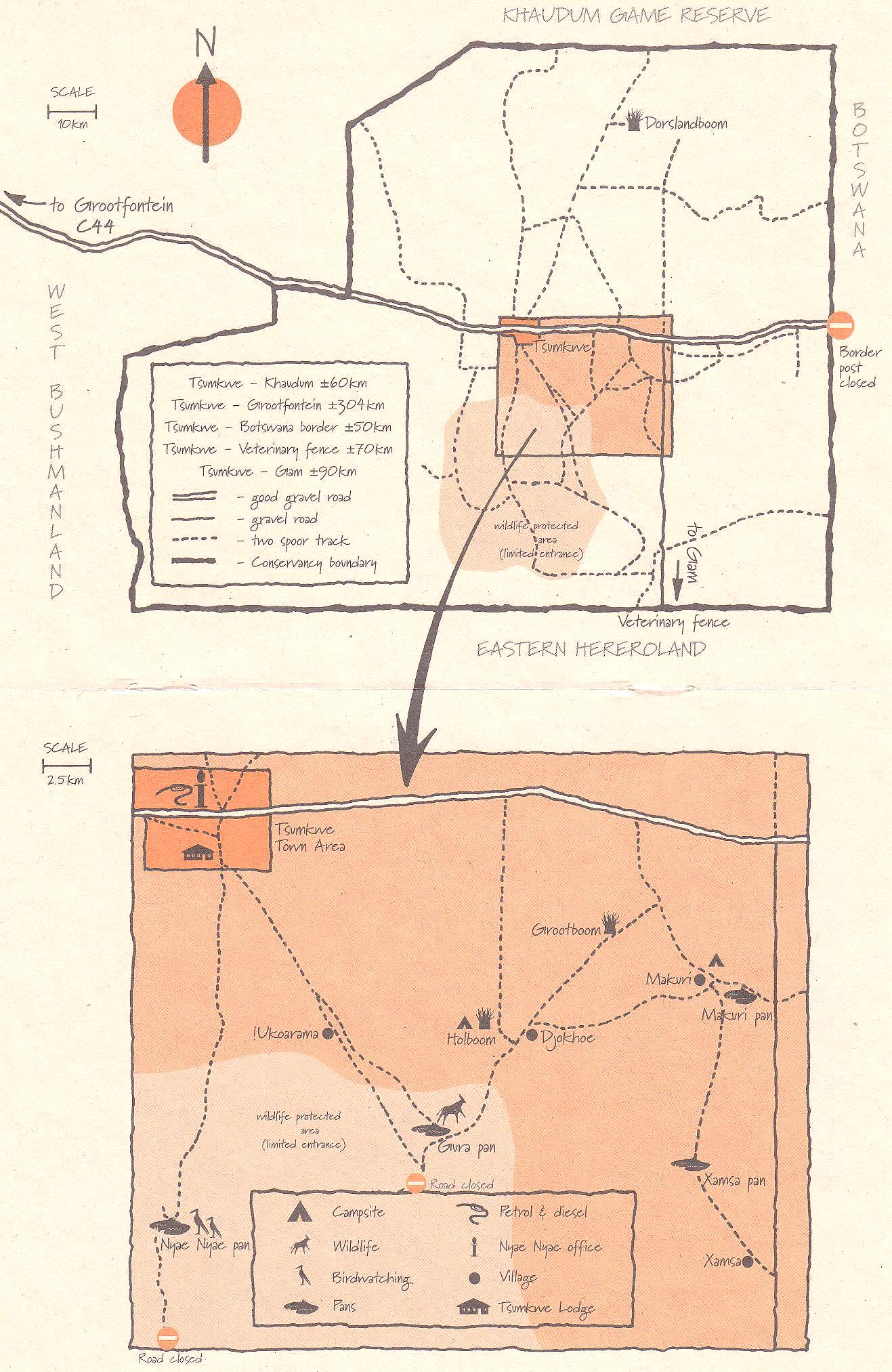
@ Nyae Nyae Conservancy
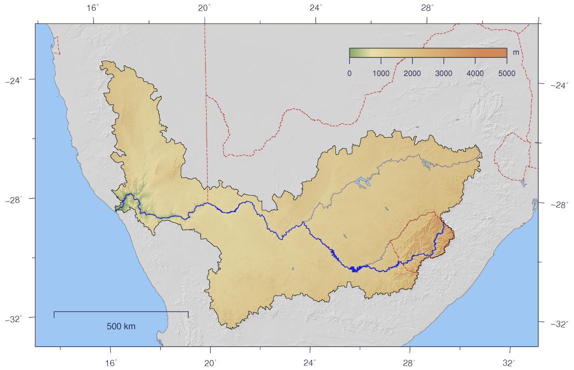
@ The course and watershed of the Orange
River
@ Trans-Kalahari
Highway
@
Palmwag concession
@
Palmwag concession-2
@ Communal conservancies in Namibia with names & dates registered
Old maps
@ Road map 1894
@ Pre-Independence map
@
Walvis Bay political map 1978
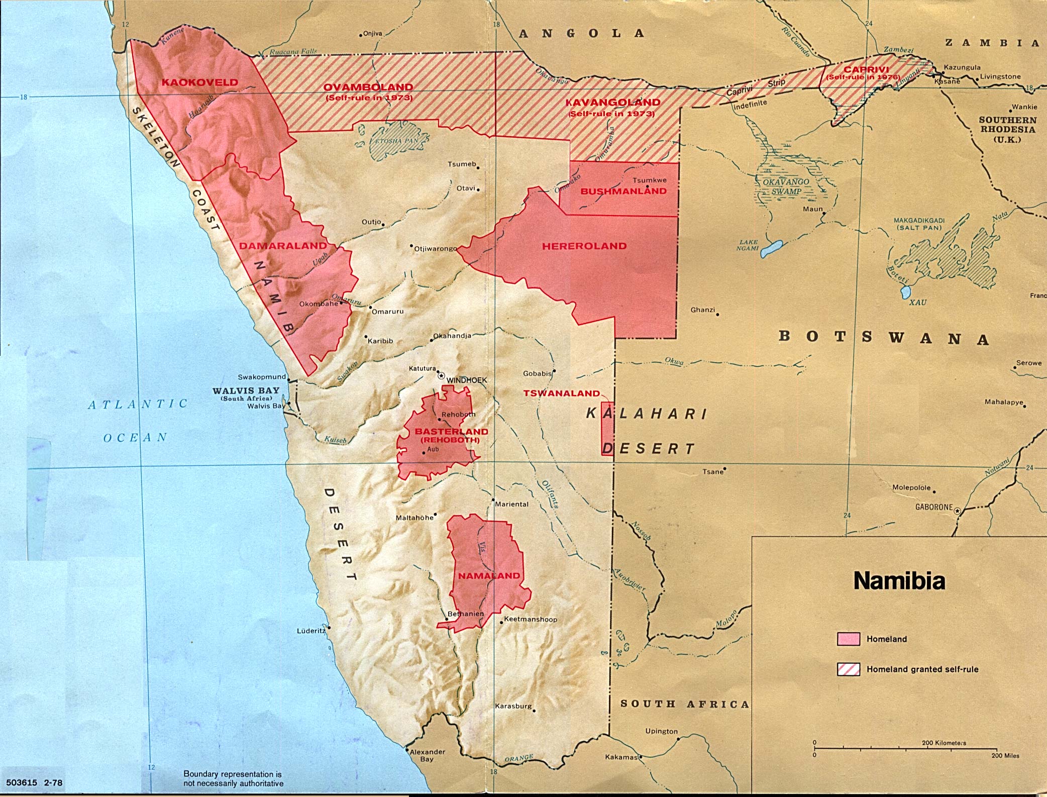
@ Map of homelands 1978
@ Relief map 1990
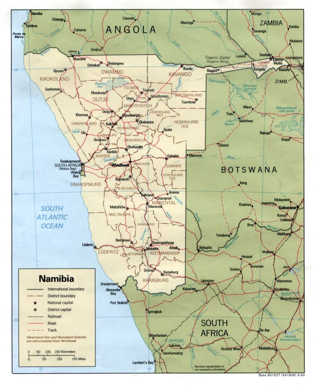
@ Political map 1990
![]()
![]()
![]()
Page created and serviced by
![]()
www.namibweb.com
Copyright © 1998-2025
namibweb.com - The online guide
to Namibia
All rights reserved |
JOIN
|
VIDEO PORTFOLIO
|
VIDEO/PHOTO COLLECTION
Telegram
| YouTube |
Blog
Page is sponsored by ETS &
Exploring Namibia TV
Disclaimer: no matter how often this page is updated and its accuracy is checked,
www.namibweb.com and ETS
will not be held
responsible for any change in opinion, information, facilities, services,
conditions, etc. offered by
establishment/operator/service/information provider or any third party