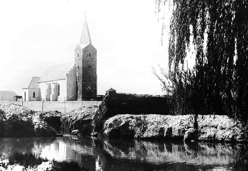
The foundation of Berseba is recorded on 17 October 1850 when Rhenish Missionary Samuel Hahn founded the missionary station and gave it a biblically inspired name. In 1857 a church was built.
Berseba
Karas Region
Berseba (Nama: !Autsawises) is a village in the Karas Region of southern Namibia and the district capital of the Berseba electoral constituency. It is situated 100 km (62 mi) north-west of Keetmanshoop near the Brukkaros Mountain, a famous tourist destination.
YouTube video of Top 5 attractions of Keetmanshoop, Namibia:
History
The foundation of Berseba is recorded on 17 October 1850 when Rhenish
Missionary Samuel Hahn founded the missionary station and gave it a
biblically inspired name. In 1857 a church was built.
People
The first people to permanently settle at this place, then only known under
its Khoikhoi name !Autsawises, were a group of Khoi herder clans from the
Cape Province, driven across the Orange River by encroaching European
settlers and the law enforcement of the Dutch East India Company. They
arrived in the area of Berseba in 1812. In 1850 their patriarch Paul
Goliath established himself as independent leader of this community that
subsequently became known as the Berseba Orlam (Nama: |Hai-|khaua).
Since then chieftainship of the Berseba Orlam has been held by the Goliath
and Isaak clans who often were in dispute about the succession. In the 1960s
the two clans split over the leadership issue and only reunited in April
2010. Today, Kaptein Johannes Isaak is the traditional leader of the
|Hai-|khaua.
Development and Infrastructure
The first diamond in Namibia was found in this area in 1898, and oil
explorations were conducted in 1900 and 1929, though neither led to
substantial industrial development. The settlement is riddled with poverty,
substance abuse, and crime. It features a secondary school, the Ecumenical
Community School, which was in 2010 declared "unfit to serve as an
educational institution" and has since been abandoned.
Berseba is connected by road to Tses (MR98), Bethanie (D3901 and D3905),
Asab (D3903), Helmeringhausen (D554) and Keetmanshoop (D531), as well as to
the Bruckaros tourist site (D3904).
Politics
Berseba is one of a few local authorities in Namibia where an opposition
party obtained more votes for the village council than SWAPO. In the 2010
local authority election, Democratic Turnhalle Alliance (DTA) defeated SWAPO
221 votes to 200. No other party participated in the election for the
Berseba Village Council.
Coordinates:
25°58'S 17°46'E
Country: Namibia
Region: Karas Region
Constituency: Berseba Constituency
Elevation: 3,041 ft (926 m)
Population:
• Total 5,000
Time zone: South African Standard Time (UTC+1)
Sights: Quiver Tree Forest & Giant's Playground, Brukkaros Volcano, Fish River Canyon
Contact & information:
E-mail:
info@namibweb.com
Facebook:
NAMIBIA: https://www.facebook.com/groups/namibia.namibia
TRAVEL NAMIBIA: https://www.facebook.com/groups/travelnamibia
KEETMANSHOOP: https://www.facebook.com/groups/keetmanshoop.namibia
Terms & conditions, Payment options and Cancellation policy
![]()
![]()
![]()
Page created and serviced by
![]()
www.namibweb.com
Copyright © 1998-2025
namibweb.com - The online guide
to Namibia
All rights reserved |
JOIN
|
VIDEO PORTFOLIO
|
VIDEO/PHOTO COLLECTION
Telegram
| YouTube |
Blog
Page is sponsored by ETS &
Exploring Namibia TV
Disclaimer: no matter how often this page is updated and its accuracy is checked,
www.namibweb.com and ETS
will not be held
responsible for any change in opinion, information, facilities, services,
conditions, etc. offered by
establishment/operator/service/information provider or any third party